Aubrey Diller (1903-1985) was long the world's leading philologist
in the area of ancient geography. Which is one of several reasons
why our 2006/12/15 publication here of
DIO 5
[2006], Diller's edition of the final book (Book 8) of
the legendary 2nd century AD Geographical Directory,
marks something of a milestone:
All other important parts of Ptolemy's Geographical Directory
(henceforth GD) have previously been published in critical
editions: see list, below.
[As long ago as 1929, the eminent classicist
Ernst Honigmann was publicly calling for accomplishment
of a reliable edition of Book 8.]
Thus, DIO's publication of Diller's rendition of Book 8
ensures that for the 1st time since the end of classical antiquity,
scholars finally have access to the complete, critically-established text
of the full GD — from the start of
Book 1 Chapter 1 right through to the end of Book 8.
[At the time of this posting the wonderful
Stückelberger-Graßhoff-Mittenhuber edition
of the complete GD also appeared (Univ.Bern 2006),
a beautiful and thorough labor of dedication.]
It is astonishing that it has taken 2 centuries
for the text-establishment process (begun c.1800) to be completed
— after all, the GD is
THE most written-about geographical work in the history of the field.
(See, e.g., Wm.Stahl Ptolemy's Geography: a Select Bibliography
NY Public Library 1953.)
A partial list
(emphasizing scholarly editions)
of the other GD parts' publications:
J. Lennart Berggren and Alexander Jones (GD 1 & 2.1)
Ptolemy's Geography Princeton 2000 pp.57-95, English.
Carl Müller (GD 1-5) Paris 1883&1901,
Greek & Latin.
(Thorough [actually overthorough] if non-ideal apparatus.)
Friedrich Wilberg & Carl Grashof (GD 1-6)
Essen 1838-1845, Greek & Latin.
(Scrupulous apparatus.)
Karl Nobbe (complete GD 1-8) Leipzig 1843-1845, Greek.
(Very brief [purely verbal] apparatus at 3:190-207.
But complete [all 8 books] and exhaustively indexed
for both geographical sites and Greek words.)
Louis Renou (GD 7.1-4) Paris 1925, Greek & French.
(Thorough apparatus.)
Otto Neugebauer (GD 7.5) Hist Ancient Math Astron
Springer 1975 (data discussed p.935), English.
(Not a translation of the chapter.)
Otto Neugebauer (GD 7.6-7)
Isis 50:22 (1959), English.
J. Lennart Berggren & Alexander Jones (GD 7.5-8.2)
Ptolemy's Geography Princeton 2000 pp.108-121, English.
Alfred Stückelberger, Gerd Graßhoff, Florian Mittenhuber,
Renate Burri, Klaus Geus, Gerhard Winkler, Susanne Ziegler, Judith
Hindermann, Lutz Koch, Kurt Keller
(complete GD 1-8) Handbuch der Geographie,
Bern University's Institute for Classical Philology 2006, German.
I first conversed with Aubrey Diller by telephone from San Diego
on 1979/11/26. (At the time, he was Prof. Emeritus
of the Indiana University Classics Department.)
I was delighted to impart to him the startling news of
independent vindication of his 1934 solution to Strabo's Hipparchan
klimata
(which had then-recently yet-again been [unjustly] denigrated,
in Otto Neugebauer's [justly] valued
History of Ancient Mathematical Astronomy [HAMA] Springer
1975 p.734 n.14) —
proving
that these klimata were computed by spherical trigonometry
(just as Ptolemy later computed them).
For the original 1934 paper, see Aubrey Diller. Klio 27:
258-269: “Geographical Latitudes
in Eratosthenes, Hipparchus, & Posidonius”.
There are now various proofs that Diller was right.
See D.Rawlins Publications of the Astronomical Society
of the Pacific 94:359-373 [1982a] p.368.
Also R.Nadal and J.Brunet 1984.
Archive for History of Exact Sciences 29:201-236 [1984]. And
DIO 4.2 [1994]
p.56 Table 1. Detailed discussion & update, plus repeated
unanticipated discovery of new data
that perfectly fit-confirm
Diller's theory, at:
http://www.dioi.org/cot.htm#tdst and thereabouts.
Diller later reported (1980/1/24 letter to DR) his happy astonishment
at the crucial 1934 discovery's surprise-reincarnation:
It was somewhat dramatic for my old article, after 45 years of oblivion
or abuse, to be rescued by a phone call from a stranger in San Diego.
I thank you for the recognition.
We were never strangers after that.
His letter went on to say that his approach was primarly non-mathematical.
(Considering the import of his 1934 solution,
I always thought Diller much too modest about his math ability.)
“I spent a good deal of time
on the manuscripts in Europe in 1950-2.”
Diller kindly sent (1980/2/11) a copy of the G.Olms 1966 reprint
(Hildesheim, Germany) of the old Karl Nobbe 1843-1845 edition of
the GD
(then still the sole complete respectable edition,
whatever its shortcomings), for which Diller had written the (Latin) Preface.
A few years later, I moved back to my native Baltimore.
During the long 5000 km cross-country drive,
I stopped to see only one person: Aubrey Diller.
On 1982/8/4, I phoned him from Illinois to say that
I could drop by for a visit that evening —
and (after a dangerous highspeed night-drive through a severe rainstorm)
I finally arrived at his apartment at 11:30 PM,
dressed in a huge cowboy hat
[relic of crossing the Rockies with minimal sunburn]
and shorts! The door opened, and Diller appeared:
such a civilized gentleman, that I am amazed he welcomed
the apparition I indubitably presented to his sensitive sight.
He was a frail-looking scholar with very long hair —
but I soon realized that, though fastidious,
he was anything but frail when expressing his opinions.
(During comments on modern morality, he asked
if I'd ever been divorced and seemed relieved that I hadn't:
“It's so cheap.” Emphasis in orig.)
We had such a glorious good time talking
— mostly about our mutual fascination, ancient geography —
that it was 2:30 AM before we parted.
But the issue of this fateful meeting was to be more
than a lifelong friendship. As we chatted on 1982/8/4-5,
I learned that Diller had for years been quietly compiling
a vast index-card file of all mss' data for Book 8 of the Ptolemy
Geographical Directory. I knew that the material was
vital
for evaluating the basis of what survives of ancient mathematical geography.
Soon after, I was able to put Diller's Book 8 gatherings
to good use in a talk at the Longitude Zero Symposium
(held at the National Maritime Museum in Greenwich [London, 1984],
commemorating the centenary of the Greenwich Meridian —
DR's paper reprinted at Vistas in Astronomy 28:255-268 [1985]),
describing his theory that Book 8 or equivalent
was the ultimate math-foundation of the grid-network
underlying
Books 2-7. (The germ of the theory was initially published in
D.Rawlins Publications of the Astronomical Society
of the Pacific 94:359-373 [1982a] p.368.)
It should be noted that Diller himself never accepted
this DR theory — as I learned during
a chat of 1983/1/26 — though he was far from adamant on the issue.
Diller also knew of my views on Ptolemy's integrity,
but he had no strong opinion on that controversy,
and it never came between us in the slightest.
[Note contrast to certain religious & cultist fanatics.]
At our first meeting and later, I urged Diller
to put together a completed edition of Book 8: preface & data.
Despite a 1983 heart attack, he warmed to the idea,
and I liked to think that (in his 80th year),
such a project as we contemplated would be healthful as well as fruitful.
Diller found that he needed one more original GD ms,
the Seraglio manuscript (Istanbul) which the Newberry Library
(University of Chicago) fortunately possessed photographs of.
With the kind assistance of the Newberry's Lucille Wehner and David Buisseret,
I arranged (and paid) for a microfilm
to be sent Diller (1983/8/18 & 9/21).
I visited Bloomington 1983/10/30-11/3, and we spent alot of time
with each other. Diller even drove me to see his favorite bucolic scenes.
(He was quite a walker.) And we took a day
to visit the wellknown Brown County Art Gallery.
We usually ate together in the IU dining room.
I learned that he had stopped smoking many years ago
because it caused headaches.
We agreed that without those headaches, he'd probably be dead long since.
Diller was a lifelong bachelor whose manner probably seemed abrasive to some.
He was never reticent about his vast amusement
at my amateurish mangling of Greek pronunciations.
(Though I feeble-defensively asked how we know
what ancient pronunciation was like.)
But such interaction never got in the way of good fellowship.
Though not a professional mathematician,
Diller was far better at math than I will ever be at any foreign language.
Regardless, between us, we had (in extreme shares)
all the talents requisite to doing a full edition
of the Ptolemy GD,
and it is unfortunate that Diller could not live long enough
to join me in such a project.
I happened to phone Diller on 1984/9/3, when he had just that very day
essentially completed the edition of Book 8 that appears here.
He sent it to me on 1984/10/3 — which was a valued token of trust,
in a day when plagiarism is not as uncommon as it ought to be.
Aubrey Diller passed away the following year.
I am grateful and honored that Diller left his ultimate scholarly contribution
to DIO. Its publication here marks the fulfillment
at last of a promise made to him years ago.
I hope that the result will add to the lasting memory
of one of the purest scholars of his & my century (the 20th),
whose friendship was to me at once a pleasure and a privilege.
Notes added 2006/10/15:
The Diller-GD project has now lain much too-long unpublished,
but this may prove fortuitous in that it has allowed the young
yet already eminent classicist (and rare scholarly-gem discoverer)
Alexander Jones (University of Toronto), to vet the release of the work.
It has also allowed fermentation of DR's theories
of the GD's evolution.
See occasional observations below.
A few minor clarifiers:
[a] The wordekumene
(oικoυμενης) —
from which the ecclesiastically-ambitious word “ecumenical”
derives — should be translated: the inhabited or known world.
[b] Also, DR would of course use “latitude”
at some of the places (in GD 8.1-2)
where Diller's translation says “declination”.
On such points, the Berggren & Jones 2000 pp.118-121
translation of the brief G8 preface is superior to Diller's.
(Though, keep in mind that the Diller ms was to be jointly edited by us
[a project cut off by his death],
which would have removed astronomical ambiguities.) Regardless,
Diller's great GD contribution is his pioneer establishment
of the mass of Book 8 numerical data.
Only one person can perform such a deed first.
This alone would merit his scholarly immortality —
which is virtually overkill, since he had already
assured his eternal remembrance by his mathematical
detection
of the scheme underlying the Hipparchos-Strabo
klimata, revealing use of
sph trig earlier than anyone had known (until Diller's 1934 paper),
as well as the best ancients' adoption of an accurate obliquity
(23°2/3,
correct within c.3') which had not survived in mss that came down to us.
[So long as the cults of
Gingerich (AAS-HAD & JHA) and Neugebauer
continue to remain unable — through
their group-intellect's failure of sharpness and-or independence —
to recognize (even the possibility of value in) this epochal
and repeatedly surprise-vindicated-on-the-nose Diller double-discovery,
DIO will continue to regard them with the contempt
which cultish mind-lock and censorship invite.]
Thanks are due here to DIO Editor, Dennis Duke,
for getting the GD Book 8 project re-started early in 2006,
as well as for restoring the original 1984 Diller ms to a publishable state.
Expert advice from Alex Jones and Len Berggren headed off potential mis-steps.
Also to be thanked is a longtime family friend, the late Prof. Emeritus
Jimmy Poultney (for many years one of the stars of the Classics Dep't of
the Johns Hopkins University), who kindly oversaw DR's early work
on Diller's final opus; and David Rockel, who patiently assisted
in the collection of materials used in DR's research.
Finally, with a sentimental mix of sadness and gladness, we note
that this marks the 5th time that DIO has published
the ultimate paper of one of the world's pre-eminent scholars in his areas
— the plural denoting that each was, remarkably,
an accomplished figure in more than one field:
Charles Kowal
Robert Newton
David Dicks
Hugh Thurston
Aubrey Diller
Distillate from 3 Decades of
DR Researches into the GD
1979-2007
[In 2008, paper copies of these researches were sent
to our library subscribers, in DIO 14 ‡3 [pp.33-58].
Readers who wish their own booklet paper copy
(of this or any DIO) may download the appropriate
pdf, gratis.
[This version (or the corresponding web
pdf)
includes [p.58] an extensive References section.
It also includes [p.50] a postscript rendition of the GD's
projection of the inhabited world (ekumene),
which fulfils the originator's vision
more perfectly than the Nobbe version (reproduced here)
or any other previously published (since antiquity, at least).]
Unless otherwise indicated, GD section-numbering here
follows that of the Nobbe edition
(Leipzig 1843-1845), numbering which has
fortunately also been adopted as closely as possible by the excellent
new Stückelberger & Graßhoff 2006 edition.
Note that the present paper forgoes the use of accents for Greek words here.
Diller himself pointed out their superfluity, since classical-era Greek
lacked accents. During a DR 1987/6/1 visit to the Vienna Papyrus collection,
the same view was expressed by the head of the collection,
as well as by the able Dutch scholar Peter Sijpesteijn,
who happened to be visiting the same day.
The famous Ptolemy Geographical Directory
(henceforth GD), popularly called “The Geography”
(sometimes “Geographia”), is in Eight Books.
The GD begins with explanatory Book 1,
which tells of Ptolemy's incorporation of thousands of sites'
geographical places from the work of an earlier geographer, Marinos of Tyre.
Then, Books 2-7 list about 8000 sites' positions, expressed consistently
in degrees: longitudes in degrees east of the Blest Isles
(Cape Verde Islands), and latitudes
in degrees north or south of the Equator.
[DIO's people are amazed at a long tradition
of suggestions that the GD may well be
the earliest geographical work ever to use spherical coordinates.
This is less scholarship than a relic of Neugebauer-salesmanship for Ptolemy.
(Origin: O.Neugebauer, HAMA 1975 pp.337, 846, & 934; and see p.280
for parallel celestial semi-claims for the Almajest,
despite Hipparchos' 2nd century BC Commentary's listing of
dozens of stellar Right Ascensions & Declinations.)
[Long before Ptolemy, Strabo reported a Nile map
consistent
with use of spherical geographical coordinates, and which goes back at
least to Eratosthenes (3rd century BC) — a map so antique
that it does not even use degrees.]
The GD then concludes with what DR
contends resembles and-or
partly constitutes the data-base grid-network
underlying
the precision-corrupted positions of GD Books 2-7, namely:
Book 8, whose data are expressed entirely in hours (not degrees),
a list of 360 sites' longitudes in hours
west or east of Alexandria and (instead of latitude)
longest-days (for Summer Solstice) in hours, where parallels
at 1/4-day intervals of M were called
“klimata”.
E.g., longest-day M = 14h1/2 was called the Rhodos klima
where L = 36° (via the below equation).
Diller was (1983/3/6 letter to DR) the 1st scholar to point out
the 360-site total and to suggest its deliberateness.
[The total of his lists is 359. Nobbe's total is 358.
But Nobbe omits Tarentum and Sousaleos, while Diller
semi-omits Limyra.
Merging the lists, we have exactly 360 sites in 26 sections,
corresponding to GD 2-7's 26 maps.
Sections: 10 of Europe (118 GD 8 sites),
4 of Africa (52 GD 8 sites),
12 of Asia (190 GD 8 sites).
I propose scholars' agreement upon a conventional numbering of all 360,
based upon the sequence of Diller's XZ Codices,
dovetailing with the UNK Codices (to cover sites either skipped),
which follows Diller's desire to give primacy to the former.
We use prefix D, to number every GD 8 site,
so that “D x” refers to the xth site.
Adding to Nobbe's edition of GD 8:
Tarentum (GD 3.1.12, 8.8.4) as site D53,
Sousaleos (GD 3.3.4, 8.9.3) as site D63.
(Note that we are dovetailing
these two sites into Nobbe in passages that [exceptionally] already list
more than one site — which may help explain these two oversights.)
To Diller's version, we add Limyra (GD 5.3.6, 8.17.25)
as site D193, Diller XZ Codices Asia-Map 1 site #22→#22a:
“Myra”, whose coordinates are identical to Nobbe's
“Limyra” at GD 8.17.25.
D192 is UNK's item#22, whose coordinates are identical to Nobbe's
GD 8.17.23, “Myra”
(GD 5.3.6). Note that one finds
“22a” in Diller's hand in the left margin of his p.X13, showing
that he suspected the need to add
this site as the final touch to perfecting his epochal document.
I.e., even at age eighty-plus, his sharp eye was still missing nothing!]
The longest-day M (in hours) at a site is a sph trig function of
latitude L (in degrees) and the Earth's obliquity ε
(also in degrees), by an equation known
at least since the 2nd century BC
(Bithynians Theodosios & Hipparchos)
— a remarkable historical revelation, which we
recall is primarily owed to
Aubrey Diller's 1934 mathematical investigation.
[Readers not into sph trig may now skip
the next few paragraphs.]
Th equation for computing each klima is
attested
for the 2nd century AD at Almajest 2.3:
(where obliquity ε was usually taken to be 23°5/6 or
[Diller's discovery] 23°2/3).
Why different data-format for
GD 2-7 vs GD 8?
Two possible answers: [1] Books 2-7,
like the important-cities part of Ptolemy's Handy Tables,
are in the form of Marinos' manual or map, presumably
after his (?) systematic tectonic
mass-alterations (GD 1.4 & Berggren & Jones p.46)
to force macro-geographical accord with the
above-hypothesized
network-grid-basis, which had been severely pre-corrupted
by astrology tables' roundings.
Remarks at, e.g., GD 1.18 suggest that, like (following?)
Hipparchos, Marinos clumped cities
under parallels. Also, Marinos gave
primacy (ibid 1.20) to
Hipparchos' 36° parallel through the east-Mediterranean island of Rhodos,
suggesting both an astrological tradition
and even the possibility that his table of parallels
(for at least the Mediterranean-region) was a hand-me-down from Hipparchos,
whose main observatory was located on Rhodos (D149),
probably just north of the town of Lindos. (See
DIO 4.1 [1994]
‡3 §F [pp.42-45].)
[2] The data of Book 8 are not for a map — but are
in precisely the hour-based form
for astrologers' convenient use in computing a horoscope for
a site other than Alexandria (D149), which was obviously the standard meridian
for astronomical & astrological ephemerides in the Hellenistic world.
[The very choice of longest-day (instead of latitude)
as GD 8's measure of northerliness
tips us off to the astrological connexion. (Hardly a stretch:
recall that Ptolemy compiled the superstitious horoscope-delineation book
that is still astrologers' bible: the Tetrabiblos.
Note that the geographical table in his astrologer-oriented
Handy Tables was at this stage still inconveniently in degrees.
So GD 8 could have been called
the Handiest Tables
— perfectly set up for astrologers' convenience.
Listing cities by longest-day superficially appears odd & cumbersome,
and it gave no special aid when using data for maps.
To the contrary.
However, astrological tables of the
outdoor-invisible
“Ascendant” (Almajest 2.8)
— the corner-stone of astrological “house”-division
for horoscopes — were simply easier to computationally construct
in the 1st place (math provided at ibid 2.7),
for longest-day values than for latitude values,
back in the ultra-longhand days of early use of sph trig.
The computational utility of longest-day is easy to show.
For A = Ascendant & ST = Sidereal Time, one can calculate:
cotA = (cos[15M/2] − sinST)cosε/cosST
which is simpler than using latitude L with a formula based upon
combining the foregoing two equations:
cotA = − (tanL sinε + sinST cosε)/cosST
(Astrologers' other key invisible celestial point was
the “Midheaven”. But the Midheaven MH is
latitude-independent. So, for any latitude, one need only consult
[in Alm 2.8's tables]
the “Sphaera Recta” columns [Toomer 1984 p.100],
which tabulate the relation tanMH = tanST/cosε.)
Thus, most available ancient astrological tables of houses
(e.g., Almajest 2.8) were
arranged
by klimata, i.e., longest-day.
It will help to provide an example,
using Almajest 2.8 for Rhodos (D189)
at Sidereal Time (the Right Ascension of the meridian, or Hour Angle of
the Vernal Equinox) 21h23m36s = 320°54' (which is chosen
to avoid interpolation in step 1, as will be evident):
Adding 6h or 90° gives 50°54' (the rising point on the Equator).
Then, find 50°54' in the Alm 2.8's
“Accumulated Time-Degrees” column
for Rhodos (longest-day M = 14h1/2, the basis of
this column's ancient computation and arrangement):
Almajest 2.8 (Toomer ed. 1984 p.101).
The value on the same row in the column “10° Intervals” is
zodiacally 10° of Gemini or 10°GEM 00'
= ecliptically 70°, so that is the Ascendant.
The Descendant (ecliptical point that is setting) is opposite:
250° or 10°SGR 00' (10° of Sagittarius).
The Midheaven (polar longitude of transitting zodiac point)
is then found by linear interpolation on Toomer 1984 p.100:
in the “Accumulated Time-Degrees” column,
under the “Sphaera Recta” heading, we find 312°32';
320°54' (ST) exceeds this by 8°22' of the 9°58' interval
corresponding to the 10° interval between 10°AQR 00'
and 20°AQR 00' (in the column “10° Intervals”),
so: add 10°(8°22'/9°58') = 8°24'
to 10°AQR 00', which yields Midheaven = 18°AQR 24'
(18°.4 of Aquarius) on the zodiac or ecliptical longitude 318°24'.
The Nadir is opposite: 138°24' or 18°LEO 24'.
(This establishes the four cardinal points of the astrological houses
for the chosen place & time. Division of each quarter into three parts
then establishes the twelve astrological houses,
but said division differed from one house system to another.
Sph trig-based tables of houses probably go back to Theodosios of Bithynia,
2nd century BC.) Note in passing:
finding Ascendant & Descendant (and thus house-divisions)
is the sole use most modern astrologers
have for geographical latitude. (Ancients also used latitude to enter
parallax tables, but such scrupulousness is rare among today's astrologers.)
Geographical longitude was used merely for additively
converting local time
to ephemerides' standard zero-meridian, presumably that of Alexandria.]
Fortunately, some cities' accurate latitudes
appear to have survived; two particular groups are consistent
(if we include refraction and rounding) with that optimistic conjecture.
In Lower Egypt (DR 1985 p.260; GD 4.5.53-55):
Memphis (D151), Cairo [fortress “Babylon”], and On [Heliopolis].
Note (in the context of astronomy-based latitudes): these 3 sites cluster
around the most accurate astronomical-surveying-oriented
building of antiquity, Giza's Great Pyramid,
whose latitude is correct at GD 4.5.54 (Cairo [Babylon],
thus adjacent Giza): 30°00'N.
[All three latitudes are correct, perhaps a notable Egyptian achievment
— since the GD lists Heliopolis (the Greek name for On)
at the wrong latitude (exhibiting a peculiarly Greek error),
not realizing that it is the same place
as the holy city called “On” by the Egyptians
and (Gen.41.45) the Bible. Note that the correct latitude is
associated with the ancient Egyptian name, not the later Greek one.
Details at DR 1985 p.260.]
In Phoenicia (modern Lebanon): Acre (Ptolemais), Tyre, & Sidon have errors
of only a few miles, not quite as right-On as the Egyptian trio,
but nonetheless impressive for antiquity — and highly unusual for
the GD, suggesting that Marinos in Phoenicia
(like Hipparchos at Rhodos) got particularly accurate latitudes
from his own observations or from those of local astronomers or navigators,
even while
absorbing and relaying ordmag 1° errors for regions
outside his or his associates' direct experience.
Of these six sites, only Memphis (D151) is listed in GD 8.
[Memphis' XZ (ms-tradition) longest-day (14h) appears independent;
but
the ultra-precise UNK value (13h57m) looks like it may have been
adjusted-to
(computed-from) an accurate latitude — suggesting
post-Ptolemy tampering. See the learned observations of
Berggren & Jones 2000 (p.44) upon
the two ms-traditions' relative trustworthiness and purity.]
The implication: those major cities (civilized enough to desire
and afford astronomers)
which are not listed in GD 8 show
a better chance of having
accurate GD 2-7 latitudes than those which don't.
Why hasn't it been previously noted that GD Book 1's
extensive critical discussion of Mediterranean-region scholar Marinos' data
fails to provide unambiguously a single Marinos latitude
in degrees for any Mediterranean city? —
or, indeed, any city within the Roman Empire.
[Could Ptolemy have made the omission deliberately?
I have doubts on that point; however, such silence would be similar
to the slyness evident in his
Almajest 3.1 suppression-silence
regarding the times of the solstice-observations of Aristarchos
(truncated)
& Hipparchos (good to 1h!),
omissions 1st stressed by the late W.Hartner (letter to DR). See
DIO 1.1 [1991]
‡6 §§A5&B3-5 [pp.50-52]. Note the key correlation:
these two solstices are the only members of Ptolemy's extensive set of times
of solstices & equinoxes that do not agree with his (Hipparchan) tables,
and they are the only ones for which he hides the hour.
(Each disagreed with his tables by 1/4 day.)]
So, though Marinos' latitude for Okelis
(D281) hints at inferior accuracy, we cannot tell for sure whether
his important-city latitudes were as corrupt as the GD's.
I.e., Ptolemy's silence on Marinos' latitudes within the Roman Empire
leaves open the possibility that
Marinos' latitudes for Mediterranean or Roman Empire sites were
accurate
(if so, GD data-degradation occurred after his time) —
and were thus suppressed for disagreeing with those of Hipparchos. But would
encyclopedist Ptolemy expend the huge effort required for shifting 8000 data
to dovetail with an underlying the grid-network's
few hundred important cities?
(Ptolemy does report [GD 1.18]
that much of Marinos' data for minor cities were incomplete and-or scattered,
so serious labor [on someone's part] was required
for subsequent estimation
of positions' precise longitude & latitude.)
Yet, if Marinos were an astrologer,
why would he give longitudes in degrees
— and worse, in degrees from the Blest Isles, not Alexandria?
(Yet, Ptolemy's astrologer-fave Handy Tables did likewise.)
The actual purpose of using the Blest Isles as longitude zero was
probably to eliminate east-west positional sign-ambiguities — just as
NPD does for north-south.]
With arguments available in both directions, it is hard to be sure how much
responsibility (for the corruption of GD 2-7's latitudes)
is borne by Marinos.
In favor of Marinos being a geographer, not an astrologer,
is the measure of longitude in degrees
from the Blest Isles. Which in turn implies that key sites'
latitude-corruption from rounded longest-day klimata was not Marinos' doing.
After all, how could it be that an (apparently) eminent geographer
from Phoenicia (a legendary naval center,
for whom latitudes and stellar declinations would have been vital
for navigating commercial vessels if nothing else)
was ultimately — via his own or others' sph trig
— depending, for his latitudes, upon
crudely-rounded astrological tables?
(Of longest-day data: see below.)
If he was. Note that the Marinos-of-Tyre-based
GD 5.15.5&27 latitude of Tyre is just about exactly
correct (to its 5' precision) if based upon observations of circumpolar stars
(affected by c.2' of atmospheric refraction), a wise and effectively
parallax-free latitude-determination method which may go back
to the time of the Great Pyramid.
(See Rawlins 1985 pp.255-256, as well as D.Rawlins & K.Pickering
Nature 412:699 [2001/8/16]; see also
DIO 13.1 [2003]
[pp.2-11.)
[Similarly, Hipparchos knew his own latitude,
but seems to have been weak elsewhere,
e.g., placing Athens a degree south of its actual latitude
(Commentary 1.11.3&8) and Babylon 2°1/2
north of its — both values
copied by the GD.]
So: what was the purpose of Marinos' geography? Naval? Or natal?
If latitudes based upon longest-day data were Marinos',
this would raise the suspicion that he was an astrologer. (Possible, but
— as already noted —
his reckoning longitude in degrees
and from Blest Isles is contra this idea.)
Were famous ancient astrologers analogous to modern popular-science
writers and publications, where ubiquity, lucre, and hype obscure
innumeracy,
thereby nourishing blind-leading-blind multi-generational
replication
of unreliable scholarship?]
GD 8.2.1 states that the data
of Book 8 were computed from latitudes & longitudes.
However, a detailed mathematical case
has been made by D.Rawlins Vistas in Astronomy 28:255-268 [1985] that
(though the remote-past origin of longest-day M data were obviously
computed from latitudes) the highly corrupted latitudes of major cities
listed in GD Books 2-7
must have been
computed (via the 1st of the above equations)
from conventionally
over-rounded M-data of just the sort we see in Book 8.
Flagrant examples appear below, e.g.,
for Babylon
and Vietnam.
[This is not to deny that some GD calculations
went
in the other direction — nor even to reject the distinct possibility
that GD 8 was all computed from GD 2-7
(data themselves already corrupted
by calculations from a prior pool of longest-day data) as alleged.
But some differences
in the two mss-traditions (Diller's XZ vs UNK) occasionally
remind us that post-2nd-century AD revisions of the GD 8
values may have attempted arranging consistency,
in the same spirit that latitudes in GD 2-7 were adjusted
at some point (at or before Hipparchos' era),
according to the DR theory of the GD.]
The suggestion here is that distortions in GD latitudes
go back at least to Hipparchos. (Note that this theory
has here been limited to proposing the high likelihood
that data of the sort provided in
GD 8 underlay GD 2-7's major cities.)
The distortions in longitude probably occurred later than Hipparchos, since
they involve a shift
from the Hipparchos 252000-stade Earth-circumference to the 180000-stade
Earth-size which fellow-Rhodian Poseidonios seems to have switched to
(Strabo 2.2.2) during the 1st century BC.
(Though C.Taisbak
eruditely wonders if this switch wasn't much later.)
The Almajest was still using the larger Earth-size
during the mid-2nd century AD, and the earliest rock-certain attestation
of the smaller value's use is by Marinos, around the same time.
[Berggren & Jones 2000 p.14 n.10 show excellent judgement
in rejecting a misguided but persistent tradition of manipulating the stade,
to force disparate
ancient Earth-measures to agree with each other or reality. See also
Rawlins Archive for History of Exact Sciences 26 pp.211f (1982);
DIO 6 [1996]
‡1 §C14 & n.47 [p.11].
The unpopular but evidentially-insistent fact that Eratosthenes'
Earth-circumference was genuinely (not
illusorily) high by
1/5, and Marinos-Ptolemy's too low by 1/6, is shown by 3 considerations:
[1] Ptolemy's expansion (by over 1/3) of the longitudinal distance from
Rome to Babylon between Almajest and GD.
[2] The GD's similarly large (33%-40%) systematic
over-estimate of actual longitudes. (See DR's least-squares test at
Vistas 1985 p.264, leading to p.265's table of reconstructions.)
[The first scholar to sense that ancients had multiplied
longitudes by adjustment-constants (when adopting new Earth-sizes) seems
to have been Pascal Gossellin Géographie des Grecs 1790.
(See his several tables exploring this hypothesis;
also DR 1985 n.22, which credits Gosselin & van der Waerden
for this important realization.)]
[3] DR's neat common explanation of both C-values' errors
from
atmospheric refraction of light with 1/6 the curvature of the Earth.
All 3 of these evidences are consistent with each other and with realization
that Ptolemy (or his source[s]) adopted the genuinely smaller Earth entailed
by his 700→500 stades-per-degree shift. Thus, there is not only
no case-for but no longer even any need-for the literature's
ever-reappearing
attempts to claim that Eratosthenes got-the-right-answer for
the Earth's circumference but expressed it using an undersized stade.]
(Columbus' belief, that the shortest trip to
China's Kattigara [D356] was westward
not eastward, was much influenced by Marinos' over-tiny Earth.)
Conversely,
there are plenty of hints
that the majority of GD 8's non-major cities
may have been directly computed from data
of the sort found in GD 2-7. (Note strong evidence that
neither section was directly computed
from the other.) E.g., the greater precision of GD 2-7 data
is obviously often impossible to derive by computing from
GD 8, while the reverse is seldom impossible.
Further, late copies of Ptolemy's Handy Tables
(a work probably earlier than the GD) contain a list
of c.360 Important Cities' (364 in Halma's ed.)
latitudes and longitudes in degrees, very similar (though not identical)
in content, bulk, and sequence to GD 8. It may be
that Ptolemy simply computed the non-key sites of
GD 8 from something like this list,
as a handiest-possible
add-on to crown his GD.
However GD 8 was accomplished, it was
an astrologer's-dream Handiest Tables, the only example of its type
that survived from classical antiquity:
[1] All latitudes expressed in longest-day, for
easy entry into tables of houses.
[2] All longitudes expressed vis-à-vis Alexandria, and
[3] in hours — for converting local time to Alexandria time,
to enter Alexandria-based tables
for computation of the zodiacal positions of Sun, Moon, & planets.
Berggren & Jones 2000 p.29 notes (as did Rawlins 1985 pp.261f) specific
cases where key cities' latitudes must have been computed from longest-day.
[A semi-ambiguous detail: Almajest 2.13 refers
to the upcoming GD and refers to degrees vs the Equator
for latitudes (like GD 2-7), but it speaks of placing sites
by degrees (the measure of Books 2-7), while using the
Alexandria (D149)
meridian of Book 8 and of E.Mediterranean astronomers
& astrologers; so it conclusively favors neither side
on the relation between the GD's two data-sections.]
Regarding the preface to GD 8,
it should be added that:
[a] The preface's comments on map-distortions belong among the mass
of such material set forth back in GD 1.
[b] One of the most obvious arguments against GD 8's
data being for (non-warped) maps is that longest-day data are
not linearly related to latitude.
(Note shrinking of klimata-bands with recession from the Equator
at, e.g., Stückelberger & Graßhoff 2006 2:748-751.)
[c] The GD's regional maps have come down to us.
Granted, they are not originals; nonetheless, their fidelity
to the GD's regional dividers strongly suggest
that these are the originals in essentials. Though the maps' margins bear
longest-days marks (inevitably at large latitude intervals),
the densely-marked, dominant north-south co-ordinate
(linearly related to up-down distance on each map)
is latitude in degrees.
Which is necessary because these maps depict the locations of thousands of
cities (not the hundreds of GD 8), the great majority
of whose positions are not given at all in GD 8,
while all their longitudes and latitudes are in GD 2-7.
More indicative yet, the maps measure longitude not in
GD 8's hours east or west of Alexandria,
but in GD 2-7's degrees east of
the Blest Isles.
(See the beautiful reproductions of several such maps
between pp.128&129 of Berggren & Jones 2000.)
So: why would GD 8's preface be discussing
the construction of regional maps actually based upon
the data of GD 2-7?
Is this more residual evidence
of patch-work authorship?
Question-in-passing: What evidence is there that Marinos
had anything to do with constructing GD 8?
The absence of his native coastal Phoenicia from
GD 8 proves his non-authorship of it.
[In Nobbe's edition, at GD 8.20.18
(Jerusalem D247) the spelling of “east” changes from
ανατoλας [anatolas] to
εω [eo] for most of the rest of GD 8.
If this is meaningful (and mss disagree), it is possible that this is
connected [a] to the compiler's departure (at about this point)
from a map of the Roman Empire to an extra-empire map of
different format (and less reliability), and this perhaps led
[b] to the accidental omission of coastal Phoenicia, possibly due to
the two maps' different order of site-listing around the nearby seam.
More patch-workery?]
Tyre's absence from GD 8 only
adds
to the evidence that GD 8 is
not directly connected
to Marinos-of-Tyre's Books 2-7. So it would be wrong to over-claim that
GD 8 is the father
of GD 2-7. Uncle
or cousin
might be nearer the mark. For, longest-day data
(the stuff of GD 8) are obviously the basis of
the full work's flawed grid-network of important-cities' latitudes —
a grid which typically misplaced geographically-key cities
by ordmag a degree, grossly mislocating the latitudes of, e.g.,
Byzantion (D87 [Istanbul]) by 2° (though, as Berggren & Jones 2000
p.29 n.37 rightly marvel, the false GD latitude continued
to be believed at religiously non-empirical Byzantion until c.1000 AD!);
Carthage (D131) by 4°, a huge error (revealed at DR 1985 p.263
as due to false M) that enormously distorted maps of N.Africa
(up to the Renaissance, over 1000 years later).
Not to mention Babylon (D256) by 2°1/2 (idem n.13)
— a discrepancy which is difficult to reconcile
with a modern historian-cult's non-empirical
insistence
that Greece had high-astronomy debts to Babylon.
[It is common knowledge that
the longest-day value (GD 8.20.27) for Babylon (D256),
14h5/12, is a rounding of 14h2/5
— which is 3/5 of a day and the M basis of
computation
of the revealingly inaccurate latitude L = 35°N
(GD 5.20.6).]
DR suspects that the latitudinal shortcomings of
the GD's basic grid-network derive
primarily from astrologer Hipparchos (not Marinos or Ptolemy):
see hint
at GD 1.4.2 (& 8.1.1), where is cited
Hipparchos' listing of cities under-the-same-parallels
(“klimata”)
— obviously for astrologers'
convenient entry into
common longest-day-based tables of houses. This step typified the fateful
Ptolemaic sloppiness
which (DR's theory proposes) was the prime source
of latitude-accuracy's corruption in GD 2-7.
[There remains the question of whether Hipparchos was responsible
for the fateful step of converting crude tabular longest-day M values
from hours to degrees of latitude L. In the light of DR's 2007
realization of
just how admirably accurate Hipparchos' longitudes may've been,
the odds that he was not the culprit
are enhanced.
Has the remarkable irony been noted that
the Geographical Directory (at GD 8.1.1)
itself scoffs at the common folly of clumping cities under parallels?
Or that this contradictsGD 1.4.2, where Hipparchos is praised
for his alleged aloneness in performing the very same clumping?
Of course, the GD 8.1.1 complaint is merely that
parallel-lists [like the pre-Ptolemy one of Pliny (77 AD): analysed at
Rawlins 1985 p.262] waste time and space, but the statement is valuable
in its suggestion of ancient currency
of the very lists upon which the DR theory is founded.
(We needn't speculate anyway, on the existence of lists of a few hundred
key cities' coordinates. Just such a list survives, e.g., in the Ptolemy
Handy Tables, the “Important Cities” table of which
(N.Halma 1:109f [1822]), appears
closely related to
GD 8 in both quantity and sequence: 364 sites in all,
with 12 not in GD 8, and 8 missing in HT.
See also the two Important Cities lists provided in
E.Honigmann's
Die Sieben Klimata 1929 [pp.193f]:
Vatican 1291 [493 sites]
and Leidensis LXXVIII [a comparable number of sites].
These lists' positions are [like GD 2-7]
given entirely in degrees east of Blest Isles and north of the Equator.)
Said currency could help a defense of Hipparchos as not-necessarily
the unique source of the GD's macro-errors; however,
his fame and his citation by both Marinos (GD 1.7.4)
and Ptolemy (Almajestpassim)
argue in favor of his culpability here, though
see above speculation
on his longitudes.]
Rounding klimata to fractions of hours (Book 8's practice) correlates
to FAR cruder precision than rounding latitudes to twelfths of degrees,
which is the precision of Books 2-7's data.
Ancient longest-day tables often rounded longest-days to
the nearest quarter-hour or so. (See, e.g., Almajest 2.6,
HAMA 1975 pp.728f.)
But when using sph trig in the Mediterranean region,
a longest-day error of merely five timemin
would cause an error of nearly a full degree — which is
the actual (terribly crude) accuracy of the data of Books 2-7.
(Example of degeneracy traced in detail for
Vietnam.)
This is
(along with the large number of places whose latitudes fall
conspicuously upon exact klimata)
one of the strongest arguments for the DR theory
that rounded longest-day data (GD 8's or its type)
were the basis for the data of GD 2-7.
Note the historically important (if paradigmist-verboten
DIO 2.1 [1992]
‡3 §C10 [p.31]) lesson imparted:
competent ancient geography's heritage to us was severely corrupted —
crippled is a more accurate
indictment — by the societal ubiquity of a pseudo-science,
astrology. But keep in mind
(DIO 4.3 ‡15 §C3 [p.124])
that Ptolemy worked for the newly-cosmopolitan, astrology-saturated
Serapic religion, and doing horoscopes internationally requires
(then & now) 3 manuals: astronomical tables, geographical tables,
& interpretational handbook. Ptolemy's prime works were:
Almajest, GD, & Tetrabiblos.
Suggested Solution to Two Mysteries:
As shown in the tables of Rawlins Vistas 1985 p.262,
GD latitude-errors for major cities are often
sph-trigonometrically consistent with the DR theory.
See op cit p.261,
for the relevant math. See also discussion (ibid p.259) of
a further revealing point: without the DR theory presented there &
here,
how could one reasonably explain two shocking oddities
(which had evidently escaped the notice of previous commentators):
[1] GD latitudes (as already noted) are two ordmags
cruder than ancient astronomers'
latitude-accuracy. (Roughly: a degree vs an arcmin.)
[2] The GD latitude errors' large size
(again: ordmag a degree) is comparable to that
of its longitude errors — this,
though:
[a] The former should be
30 times smaller than the latter. (Or 41 times smaller,
if eclipse-observations aren't taken as raw-data pairs.)
[b] Real astronomers
knew their latitude to ordmag an arcmin.
(D.Rawlins Isis 73:259-265 [1982b] p.263 n.17.)
[Note that GD 1.2 shows awareness that
astronomical observation is the most reliable basis of latitude-measure.
This returns us to the question: if sophisticated cities knew their latitude,
how did most of these data get corrupted by astrologers?
Was there a long astrological tradition of geographical tables,
which Marinos (note GD 1.17.2's
semi-connexion of astrologers' klimata
to Marinos) and-or Ptolemy felt forced to assent to
the flawed important-cities latitudes of?
(Just as usually-equant-preferring Ptolemy may've felt forced
to go along [in the Almajest]
with Hipparchos' flawed but long-pagan-sacred eccentric-model solar tables.)]
The order of data-listing for GD 2-7
and GD 8 are similar.
(And the former's 26 local maps correlate in designation
and sequence with the latter's.) This suggests some sort of inter-causation
or co-causation.
(GD 8.2.1's statement that
GD 8's data are from degree-lists does
not say that they were those of GD 2-7,
though that may be the implication and-or the truth.)
However, throughout the GD, we find repeated instances
of differences in order-of-listing.
[E.g., Nîmes (D29) & Vienne (D28):
GD 2.10.10-11 & 8.5.7.
(Berggren & Jones 2000 p.106 vs p.122.)
Kasandreia (D101) & Thessalonike (D95):
GD 3.13-14 & G8.12.10&4. Pergamon (D178)
& neighborhood: GD 5.2.14 & 8.17.10.
Hierapolis (D237) & Antioch (D236):
GD 5.20.13&16 & 8.20.8&7.
Teredon (D259) & Babylon (D256):
GD 5.20.5&6 & GD 8.20.30&27.
Kattigara (D356) & Thinai (D355):
GD 7.3.3&6 & GD 8.27.14&12.]
Which argues against
GD 8 being computed directly from
GD 2-7 or vice-versa.
[For the consistent sites,
either there were calculations of one section's data from the other
(in one or both directions) or scrupulous attention was
paid
to math-consistency between the two sections
(whether at the outset or during later editors' touchings-up) — though
there are occasional inconsistencies,
e.g., the longitude of Rome (D49): GD 3.1.61 puts Rome
36°2/3 west of the Fortunate Isles,
while GD 8.8.3 puts Rome 1h5/8 east of Alexandria.
(Itself 60°1/2 west of Blest Isles by GD 4.5.9,
or 4h [60°] by GD 8.15.10. See DR 1985 n.25.)
But (60°1/2 − 36°2/3)/(15°/hour) ≈ 1h7/12 < 1h5/8.
Similar incompatibility: Salinae (GD 3.8.7, 8.11.4, D79).]
Decades ago, Aubrey Diller pointed out to DR that the GD
never mentions Book 8 —
until
the reader arrives there.
DR has noted something similar: throughout GD 1,
there is no mention of Alexandria, Ptolemy's
claimed home
and his Almajest's prime meridian.
[Nobbe 1:46 inserts Alexandria at the 14h klima
(GD 1.23.9), but it is clear from
C.Müller (1883) 1:57, Berggren & Jones 2000 pp.85&111,
and Stückelberger-Graßhoff-Mittenhuber 1:116 n.4
that this was not in the original,
which (in GD 1.23) named only four klimata north of
the Equator: Meroë [D165] (13h), Syene [D154] (13h1/2),
Rhodos [D189] (14h1/2), Thule [D1] (20h).
Selection repeated GD 7.5: Berggren & Jones 2000 p.111.
Note that Alexandria [D149] is mentioned at GD 7.5.13-14.]
By contrast, GD 1 mentions such sites as:
Thule (D1), Ravenna (D56), Lilybaeum (D67), Carthage (D131), Rhodos (D189),
Canopus (Ptolemy's true home),
Syene (D154), Meroë (D165), Arbela (D261),
Okelis (D281), Kattigara (D356), among many others.
Since Ptolemy is a multiply-convicted plagiarist
(DIO 12 [2002]),
one may ask: is it credible that allegedly (Almajest 3.1)
Alexandrian Ptolemy would write a preface to his Geography
which never mentions his own city, when it is the prime meridian
for his astronomical works, for his earlier-announced
(Almajest 2.13) forthcoming geography,
and for GD 8?
Conversely,
the Blest Isles, the GD ekumene's west bound
(and GD 2-7's implicit prime meridian),
have no entry in GD 8.
In GD 8, this linch-pin site is
only mentioned at two places, rather in-passing:
at GD 8's prime meridian Alexandria
(GD 8.15.10) and at the GDekumene's
east bound, Thinai (GD 8.27.13),
where it is noted that Thinai is 8h east of Alexandria
and thus 12h east of the Blest Isles.
Yet another oddity: the GD repeatedly states
that the Blest Isles are the west bound of the ekumene.
(Though, curiously, not at GD 7.5.2, even while
soon after saying so at GD 7.5.14.)
Yet the writer of GD 1 does not
explicitly state
that all the longitudes of GD 2-7 will be measured from
the Blest Isles; and the Blest Isles' has no entry in GD 8.
Its position appears under Africa at GD 4.6.34.
[Thanks to Alex Jones for pointing this out.]
Additionally, one notes that there is not a single absolute longitude
in GD 1 — every longitudinal value is given
in strictly differential terms. Now, if one is writing a preface to
a compendium that provides the longitude-east-of-Blest-Isles of 8000 sites,
one would think that the east-of-BI part just might get mentioned somewhere.
Instead, GD 1 is completely non-committal regarding
what will be the prime meridian of the work. And GD 2.1
(the preface that launches the reader into the 8000 sites) is likewise.
(If one were just grabbing — virtually unedited —
a preface to another work, something like this could easily happen.)
In the GD, there are a few islands
near Mauretania at about the latitude of the Canaries,
which are the hitherto-standard identification of Ptolemy's Blest Isles.
(E.g., Stückelberger & Graßhoff 2006 1:455 n.200,
which scrupulously notes that the identification
of the Blest Isles with the Canaries is uncertain.)
But these islands are not GD-listed at longitude zero;
nor is the center of the real Canaries longitudinally
beyond the real western hump of Africa,
which is how the western-most anciently-known land obviously ought to lie.
GD 4.6.33 lists a few non-zero-longitude islands just west
of Mauritania, including Kerne Isle at 5°E & c.26°N, which
would be the Canaries. But these are the better part of a thousand miles
north of Ptolemy's six “Blest Isles” which are listed by him
at GD 4.6.34, at longitudes 0° (four) or 1° (two),
at north latitudes ranging from 10°1/2 to 16° — which is
about right for the Cape Verde Islands.
(Actual CVI latitudes: c.75 nmi N&S of 16°N.)
The same isles are also visible on GD maps
(see, e.g., Berggren & Jones 2000 plate 6 [from c.1300 AD];
same location in plate 1;
Stückelberger & Graßhoff 2006 2:838 and volumes' inside-covers)
marked as the Blest Isles (“Fortuna insula”),
strung along a longitude of about 0°
— 400 miles west of the western-most point (hump) of Africa
(Dakar, on Cap Vert) at a latitude that is again a convincing match for
the Cape Verde Islands, which are therefore firmly identified as
the Blest Isles. (Online, the same six “Fortunate” islands
can be seen at the west end of Ptolemy's world map, again
at a position pretty consistent with that of the Cape Verde Islands.)
The persistent previous confusion presumably occurred because
the 5th of the 6 islands listed at GD 4.6.34
is called “Kanaria Nesos” (Dog Isle).
The GD's knowledge of the Cape Verde Islands stands as
a testament to ancient explorers' courage: they are
indeed c.400 miles from the mainland.
(By contrast, the Canaries are barely off the NW-Africa shore.)
So the islands' discoverer was himself the nearest thing to an ancient Eriksen
or Columbus. More than a millennium before sailors discovered tacking,
trips there were presumably extremely rare and hazardous.
Possibly galley-slave rowing-power was the key to
the ancients' knowledge of the Cape Verde Islands.
And perhaps they were regarded as Blest because European civilization
had not yet significantly uplifted the inhabitants
by the introduction of its ever-brewing wars &
their ever-resultant
slavery.
Looking at GD 1-7 and GD 8 as
separate sections of the GD,
one must notice that each of the two sections' cross-citations of
the other's prime meridian is paltry at best
(and could well have been from later interpolation) —
so let's keep our eye on the main point:
there is no mention of the Blest Isles
in the preface to GD 8,
any more than there is any mention of Alexandria in the preface
(GD 1) of GD 1-7.
It would be hard to ask for better evidence that
neither section
was the immediate direct source of the other's totality.
But let us return to the essence of
the DR theory
that the major-site data of GD 2-7 were based upon data of
the type found in GD 8, and fix upon the main points
regarding the source of GD 2-7's data:
[a] Whereas all latitudes were originally measured angles
(method: Almajest 1.12), the inaccuracy of
the latitudes in GD 2-7 show that these data
had been corrupted by subjection to crude rounding for astrologers'
longest-day tables in hours, before being computationally converted
into the latitude-degree data that ended up in GD 2-7.
[b] All astronomically-based longitudes in GD 2-7
were originally in hours, as noted in GD 1.4.
[Wrongly,
Ptolemy believed (GD 1.4&12-13) that
eclipse-based longitudes were rare.
(The method of finding longitude-differences between sites
by comparing local times of simultaneously-observed lunar eclipses, was
obviously well known. See, e.g., Strabo 1.1.12 or GD 1.4.2.
Least-squares tests on ancient longitudes show that the eclipse method
had been extensively used by genuine ancient scientists: Rawlins 1985
§§5&9 [pp.258-259 & 264-265].)
And so he assumed
that generally-accepted longitudes were
primarily based upon travellers' stade-measured distances (terrestrial)
instead of eclipse-comparisons (celestial) —
a crucial, disastrous error,
which undid generations of competent scientists' eclipse-based accurate
longitudes-in-hours and thereby wrecked
the GD's longitude macro-accuracy in angle.
(Though not in distance.)
Note: said mis-step must have occurred before the hypothetical
dovetailing
of GD 2-7 and GD 8,
perhaps
in the 1st century BC.]
This, because based upon comparisons of lunar-eclipse local-times.
[A number of network-cities' GD 2-7 longitudes could
have been calculated directly from GD 8 or its source,
using Alexandria (D149) longitude (east-of-Blest-Isles)
60°1/2 (GD 4.5.9)
or 60° (GD 8.15.10). Some examples:
London (GD 2.3.27, 8.3.6, D4), Bordeaux (2.7.8, 8.5.4, D21),
Marseilles (2.10.8, 8.5.7, D26), Tarentum [Diller
(DIO 5
[2006]) Codices XZ Europe-Map 6 site #5] (3.1.12, 8.8.4, D53),
Brindisi (3.1.13, 8.8.4, D54), Lilybaeum (3.4.5, 8.9.4, D67),
Syracuse (3.4.9, 8.9.4, D68),
Kyrene (4.4.11, 8.15.7, D146), Meroë (4.8.21, 8.16.9, D165),
Kyzikos (5.2.2, 8.17.8, D176), Miletos (5.2.9, 8.17.13, D181),
Knidos (5.2.10, 8.17.14, D182), Rhodos (5.2.34, 8.17.21, D189
— allowing for common
[DIO 4.1 [1994]
‡3 §F3 [p.43] ] ancient rounding of 1h/8 to 8m),
Jerusalem (5.16.8, 8.20.18, D247),
Persepolis (6.4.4, 8.21.13, D271).
However, these could as easily have been computed in the other direction.
The majority of less grid-critical sites' degree-coordinates couldn't
have been computed directly from those of GD 8
(at least in its present state), but could've gone the other way; e.g.,
Smyrna (5.2,7, 8.17.11, D179) & Pergamon (5.2.14, 8.17.10, D178).
Given the GD as it stands,
if GD 8 is contended to be the direct ancestor of
GD 2-7's longitudes, one would have to argue that
the underlying network-basis was far less in number
than GD 8's 360 sites — which, if we are speaking
of sites whose longitudes (vs Alexandria) had been astronomically determined,
would not (in itself) be an unreasonable contention.]
[c] Thus we have arrived at a hitherto-unappreciated
realization:
ironically, every jot of the astronomically-determined data
of the basic network of cities underlying GD 2-7's
thousands of degree-expressed positions, was at some point
(during its mathematical descent from its empirical base)
rendered in time-units: hours. As proposed in DR 1985.
And, as a result of rounded
longest-days and Earth-scale shifting,
these hour-data became
the semi-competent-occultist conduit
for data-corruption which tragically destroyed
a sophisticated civilization's laboriously accumulated
high-quality astronomically-based ancient geographical data.
Precession is the difference in the length of the tropical and sidereal year,
caused by a gradual shift of the Earth's axis — an ancient discovery
which we can easily trace back to Aristarchos (not-so-coincidentally also
the 1st astronomer to publicly announce that the Earth moved),
since he is the earliest ancient cited to two different year-lengths.
[Note: not a single historian has yet indicated publicly that
he understands this rather self-evident point. (Though some have privately.)
Which gives us hope that
sociology can yet attain to the predictivity of astronomy.]
Aristarchos flourished c.280 BC: 1 1/2 centuries
before Hipparchos, hitherto generally regarded as precession's discoverer.
Both of Aristarchos' yearlengths are provided at
DIO 9.1 [1999]
‡3 §B7 [p.33]; see also
DIO 11.1 [2002]
‡1 nn.14&16 [p.8].
Precession was known to the author of GD 8.2.3.
[GD 8.2.2 by the arrangement of L.Berggren & A.Jones
(Princeton 2000); or 8.B.2 in Aubrey Diller's 1984 translation at
DIO 5
[2006].] Thus, the GD 1.7.4 discussion seems awfully
strange (though some experts disagree: Berggren & Jones 2000 p.65 n.23
& p.120 n.3), since it here quotes the statement of Marinos of Tyre
(c.140 AD)
that all the constellations rise&set in the tropical geographical regions
— with the sole exception of UMi, which becomes ever-visible
after a northward traveler passes north latitude +12°2/5 ,
Hipparchos' long-precessionally-obsolete
NPD
(North Polar Distance = compliment of decl) for αUMi. (I.e., modern
“Polaris”: the brightest star in UMi, and the most northern
easily-visible UMi star for us; the most southern for Hipparchos.)
And αUMi's NPD actually was 12°27'
(Decl = 77°33') at Hipparchos' chosen epoch,
−126.278 (128 BC Sept.24 Rhodos Apparent Noon:
DIO 1.1 [1991]
‡6 eq.28 [p.58]).
Marinos further states that this parallel is 1° north of Okelis, which he
mis-places
at 11°2/5 N latitude.
(A poor estimate, since Okelis (D281) [modern Turbah, Yemen] is actually
at 12°41'N, 43°32'E.)
[Is this a revised&multibungled re-hash of an original Hipparchos
estimate that Okelis was on the arctic (ever-visible) circle
of αUMi? — which would have been correct in 170 BC
and OK to ordmag 0°.1 during his career.]
Yet, by Marinos' time, αUMi's NPD had precessed down to about 11°:
in 140 AD, it was 10°59'.
So, his statements prove he didn't account for precession.
But the most peculiar aspect of this matter is
that GD 1.7.4 makes no comment at all on Marinos'
flagrant omission of precession — and this though Ptolemy is (as usual)
in full critical mode (alertly questioning [GD 1.7.5]
whether any of Marinos' discussion is based upon
the slightest empirical research), and though the writer of
the Almajest certainly knew
(Alm 7.2-3) the math of precession. Comments:
There can be little doubt that the authors of GD 1.7.4
and GD 8.2.3 were not
the same person.
If Okelis were where Marinos placed it, αUMi's
ever-visible circle would have been south, not north of Okelis.
Has it been noted that, by the time of Marinos & Ptolemy,
αUMi was (thanks to precession)
no longer the most southern of UMi's seven traditional stars?!
— ηUMi and especially 3rd magnitude γUMi
were much more so.
Indeed, for the time of the GD, γUMi was
over a degree (1°04' at 160 AD) more southern than αUMi.
(Shouldn't the “Greatest Astronomer of Antiquity”
[Science 1976/8/6] have known this? — especially since
he pretended he'd cataloged the whole sky's stars:
Almajest 7.4.
I.e., the GD 1.7.4 statement on αUMi
disagrees
not only with the sky but with Ptolemy's own tables.)
Thus, γUMi had long since assumed the distinction
(one interjected by Marinos, ironically) of being the outrider-star
whose NPD determined whether a geographical region was far enough north
to attain UMi-ever-visibility.
(Note that GD 6.7.7 puts Okelis at latitude 12°N
[and false-Okelis at 12°1/2]; so, creditably, the GD's
Okelis latitude was closer to reality than to Marinos.
Note also that 12° is almost exactly the
theoretical
ever-visible latitude for all of UMi at the GD's epoch,
since γUMi's NPD was 11°56'+ in 160 AD.)
[Likewise, 1000 nmi to the southwest of Okelis:
regarding the location of the two lakes feeding the Nile,
the GD astutely makes a major correction to Marinos
in placing both lakes much nearer the Equator than Marinos had them.
(In reality: the Equator runs through the eastern source, Lake Victoria.
And the western source, lake-pair Edward & Albert, straddles the Equator.)
Remarkably, the GD's maps of Africa were still consulted
by geographers in the mid-19th century,
when these lakes were finally 1st reached by Englishmen.
(See J Roy Geogr Soc 29:283, 35:1, 7, 12-14;
Proc RGS 10:258.)]
As noted, the foregoing strongly suggests that the same person did
not
write GD 1.7.4 and GD 8.2.3.
And several other features suggest independently that the GD
is a patch-work opus: see D.Rawlins
Vistas in Astronomy 28 [1985] p.260
[On vs Heliopolis];
and p.266 & n.6.
[We find similar hints of patch-workery throughout
the GD, e.g., at GD 1.24.11-vs-17,
as the lettering for two consecutive projection-diagrams are
needlessly shuffled. (See Berggren & Jones 2000 p.91 n.80.)
See also another Ptolemy-compiled work,
the Almajest, where,
e.g., the mean motion tables' Saturn→Mercury order of the planets
(Alm 9.3-4) is the reverse
of the Mercury→Saturn order followed in their fraudulently
(Rawlins Amer J. Phys. 55 pp.236-237 item 5;
DIO 11.2 [2003]
§K [pp.48-49])
alleged derivation at Alm 9.6-11.8.
For more such patch-work indications, see frequently here, and at
DIO 8 [1998]
‡1 end-note 17 [p.17] &
DIO 11.3 [2002]
‡6 §C [p.76].]
Thus, the above analysis of GD 1.7.4 provides another
powerful augmentation of that evidential collection.
[Indicia of such patch-workery in the GD are frequently
noted here, due to the inexplicably-repeated modern claim
of coherent unity for each of Ptolemy's works.]
Nowadays, it seems to be almost universally assumed
(e.g., Neugebauer 1975 pp.879&939)
that Marinos flourished very early
in the 2nd century AD, sometime during Trajan's reign, around 110 AD.
[Quite aside from the present discussion:
for compelling evidence against this date, see
H.Müller's clever discovery.]
Which is curious, since in c.160 AD (or perhaps even later:
DIO 4.1 [1994]
‡3 n.45 [p.45]) Ptolemy refers to Marinos as
(GD 1.6.1 emph added):
“the most recent [of those] of
our time”
who have attempted a large geography.
Now, if you were currently writing of a geographer of the mid-1950s,
would you speak of him so? (GD 1.17.1 has
been taken to indicate that Marinos was retired or dead by Ptolemy's day,
but the passage is hardly unambiguous on that point — and would make
more sense if Marinos' latest publication was merely 5 or 10 years past.)
Moreover, Alex Jones points out (2007/5/23 conversation) that the forward
dating of Marinos would help solve a problem first emphasized by Paul Schnabel
(Sitzungsberichte der preussischen Akademie der Wissenschaften
1930 phil-hist Klasse XIV:214-250 p.216):
when did Ptolemy become aware that people lived south of the Equator?
Almajest 2.6 says
the S.Hemisphere is unexplored, though Marinos says otherwise
and the GDagrees.
This implies, since the Alma might've been compiled during
Marcus Aurelius'
reign, that Marinos' date could be as late as c.160AD.
The argument adduced to date Marinos to much earlier (than Ptolemy) is
that Marinos' work took into account
names of sites reflecting the changing Empire, e.g., Trajan in Dacia
(GD 3.8, 8.11.4 [roughly modern Romania]) up to c.110
— but not later in Parthia (GD 6.5, 8.21.16-18
[roughly modern Iran]) and north Africa.
But how sure is such tenuous reasoning? How strongly should it rank?
— in the face of:
[a] GD 1.6.1's plain statement
of Marinos' contemporariness, and
[b] the incredibility of the long-orthodox implicit assumption that,
in a busy mercantile empire, a succession of macro-geographers
(GD 1.6.1 implies plurality)
suddenly ceased for 1/2 a century!
Moreover, why assume that Marinos adopted all the latest name-changes?
Ptolemy didn't: his preface's criticisms complain
(GD 1.17.4) that Marinos misplaced the Indian trading town
Simylla (D330) and didn't realize that the natives call it Timoula.
Yet the GD's data-listings
(GD 7.1.6 & 8.26.3) both retain Marinos' name:
Simylla, not Timoula. Berggren & Jones 2000 n.53 (p.76) note
an even more revealing careless retention: Marinos' Aromata latitude.
[These situations remind one of the common modern mis-interpretation
(DIO 11.1 [2002]
‡2 n.7 [p.12]) of Almajest 3.7
to mean that no Babylonian astronomical records came
through to Ptolemy prior to 747 BC, though the actual statement is
rather that continuous records went back that far.]
So, what should be tested isn't whether all but whether
any post-Trajan geography appears in the GD.
Especially since it doesn't seem that there'd likely be many changes.
After all, it's well-known that Dacia was the last solid addition
to the Roman Empire. (It may not be coincidental that around this time
the Roman army was becoming predominantly alien-mercenary.)
Trajan's army was of course stronger than Dacia's.
(So, we know who ended up with Dacia's gold.)
[Trajan aureus (possibly containing said gold):
Kunsthistorisches Museum, Vienna.]
But it wasn't stronger than that of the Parthian Empire;
thus, the attempted-rape victim got in all the Part'n shots,
and the puppet ruler whom Trajan had placed into power
at the then-capital (Ctesiphon [D262], near Babylon [D256])
passed on soon after, as did Trajan (117 AD).
[Over 4 centuries of botheration,
Parthia repelled three Roman invasions: swallowing the army of Crassus
(suppressor & crucifier of Spartacus, and member of the 1st triumvirate),
exhausting emperor Trajan
and (after a temporary setback at Marcus Aurelius' hands)
slaying last pagan emperor Julian the Apostate.
And, yes, “parting shot” is thought to come from
Parthian archers' tactic of shooting arrows
even when retreating or pseudo-retreating.]
Trajan's adventure in Parthia having been an expensive failure,
his two successors chose not to try expanding the empire.
Hadrian (117-138) did not share certain current warlords' fiscal profligacy.
Similarly for Antoninus Pius
(138-161: which takes us up to the time of Ptolemy's geographical work).
[Antoninus Pius aureus: DIO Collection.]
These points urge some caution before we draw conclusions
on Marinos' date from lack of the-very-latest Parthian information.
Next, we note that the most notorious exception to the non-expansion policy
of Hadrian occurred in Palestine. In 130 AD, he visited Jerusalem
and ordered its re-building. Since Hadrian's family name was Aelius,
he re-named Jerusalem: “Aelia Capitolina”.
(His supervision evidently triggered a local revolt —
put down in 132-134, with Hadrian sometimes on the scene.)
So, does the GD reflect the change? Yes:
GD 5.16.8 lists “Ierosoluma [Jerusalem],
which is called Ailia Kapitolias”. And GD 8.20.18
lists “Ailia Kapitolias Ierosoluma” without further comment
but obviously reflecting the same up-to-date information.
[Such an explicit update is rare in the GD's data-body.
Another such passage, even more unusually discursive, is
found at GD 7.4.1, where it is stated that Taprobane
(modern Sri Lanka [though known as Ceylon in Diller's & DR's youth])
was formerly called Simoundou but is now called Salike by the natives.
Comments are even (very atypically) added, describing Salike's women
and local products ranging from meal & gold to elephants & tigers.
It seems likely that the mention of both Ailia Kapitolias and Salike were
late additions to the GD, a point
we will later make use of.]
(Note: Taprobane [GD 8.28]
is the last map in the GD, though
[given its location] it should obviously have been covered
before the GD listings get to China.
I.e., we have here yet another symptom of a late add-on.)
Therefore, we have indication that both the GD's data-sections
(GD 2-7 and GD 8), previously adduced
to date Marinos to c.110, actually
contain material from the 130s or later.
[Following the revolt's suppression, Judaea was re-named
“Syria Palestine” and Rome henceforth (c.135) eliminated
the term “Judaea”. The fact that it is retained in
both the body (G2-G7) and Book 8 of the GD,
taken together with the re-naming of Jerusalem leaves us with
a bracket-argument in favor of dating Marinos to about 135,
which is indeed of Ptolemy's time — as he said.]
An example of the fruitfulness of the foregoing:
Almost 2 centuries ago, H.Müller made the brilliant
observation
that a GD-listed N.German town “Siatoutanda”,
was probably non-existent — just
(another) Ptolemy-compilation mis-read
of a foreign language: Tacitus' Latin description (Annals 4.73)
of a N.German battle-retreat (“ad sua tutanda”).
[This does not stop our ancient geographer from
providing highly specific coordinates:
longitude 29°1/3, latitude 54°1/3
(GD 2.11.27).
Reminds one of St.Philomena, of whose “life”
whole books used to be written (DR possesses a copy of one),
though she never existed: “Philomena” turned out to be just
an over-imaginative later mis-read of a fragmentary ancient stone inscription
(found in the catacombs of Rome on 1802/5/25):
“LUMEN PAX TECUM FI”, which was “restored”
as a reference to FILUMEN or Philomena. This was enough
to launch
(starting c.1805 in the super-religious Kingdom of Naples) a cult,
special novenas, the usual “miracles”, and (from
devotees' revelations) a detailed biography of her life & martyrdom.
The Roman church creditably removed her from the list of saints
about a 1/2 century ago.]
As is all-too usual in the ancient-science community,
Müller's novel and obviously valid discovery has been doubted
on grounds so tenuous (in comparison to the compelling evidence in its favor)
as to make one wonder whether anything ever gets resolved in this field,
no matter the power of
relative evidence.
[What does that say about the field? See
DIO 7.1 [1997]
‡5 n.40 [p.33]. Note the Velikovskian context.]
Against Müller, it has been argued
(see sources cited at Berggren & Jones 2000 p.28 n.34)
that the Tacitus work was published in 116 AD, which is after
the (inexplicably-widely-believed) upper-limit date (110 AD) for Marinos.
But the 110 date is so far from firmly established that
one should reverse the situation: instead of using the date to exclude
H.Müller's finding, use the HM finding to help establish
a lower limit for Marinos' date.
[Similarly, when (1999/10/1) dim atmosphere proponent B.Schaefer
imparted to DR his intention of testing the Ancient Star Catalog's authorship
by assuming 0.23 mags/atm opacity, DR immediately suggested that
it would be far more fruitful to use Hipparchos' authorship
(which had by then been obvious to serious astronomers for centuries)
to test for ancient atmospheric opacity.
BS didn't listen, so this important and revealing project
— proving beyond any question that man (not nature) is the prime cause
of present atmospheric opacities ominously higher than ancient skies' —
was instead masterfully and independently established by Keith Pickering
in DIO 12 [2002]
‡1 §§D2-D5 [pp.11-12].]
So we recognize that H.Müller's discovery
contributes importantly to the evidence suggesting
that conventional wisdom on Marinos' date is suspect,
and thus that there is little trustworthy evidence against our proposal
that Marinos was much nearer Ptolemy's contemporary than is now
generally understood.
Tyre: Missing
Home-City of Book 8's Once-Supposed
Source
The most peculiar coincidence in the history of ancient geography will
turn out to be a lucky break for scholars of the GD: incredibly,
Marinos' native Tyre is absent
from GD 8.
Tyre's absence from GD 8 has several non-neatnesses.
While Tyre is also missing from the Important Cities lists
in late copies of Ptolemy's Handy Tables (Halma ed.),
Tyre does reside in two 9th century copies
(published by Honigmann),
which are far older than our earliest mss of the GD,
and each contains c.100 more sites (than GD 8):
Tyre is city #307 in Vat 1291, #160a in Leid.LXXVIII.
In the latter ms, Tyre is counted secondarily; which suggests
that, if paring occurred, Tyre was expendable.
The superficially attractive interpretation is to wonder
if GD 8 is a Byzantine-era add-on, which reflected
a shrinking of the number of sites from nearly 500 to just 360.
The problem with that theory is format: GD 8 differs
generically (from all other surviving Important Cities lists,
which uniformly are in longitude degrees east of the Blest Isles
and latitude degrees north of the Equator) by:
[1] using Alexandria
as prime meridian (astrologer Ptolemy's preference); and
[2] providing data entirely in hours, just as astrologers prefer.
This argues strongly that GD 8 goes back in time
at least as far as Ptolemy.]
Curiously, this telling point has been
overlooked
in the literature. And, in a context of questionable authorship, we must
notice that, while Marinos' home-city (Tyre) is missing from
GD 8,
Ptolemy's alleged home-city
(Alexandria) is likewise missing from GD 8.
Marinos is clearly identified as of-Tyre (GD 1.6.1).
Indeed, Tyre (Phoenicia) is cited doubly and with accurate latitude
— highly exceptional on each count —
at GD 5.15.5&27:
67° E of Blest Isles, 33°1/3 N of Equator. (The latitude is
correct
if we account for refraction of pole-star light and 5' rounding.)
Thus, we conclude that GD 8
(in the form we have it) was not compiled by Marinos.
It is well-known that the farthest-east region of the GD,
China, portrays a non-existent continuous roughly-north-to-south coast
(blocking any route to the Pacific) beyond the South China Sea,
near longitude 180° (12 hours) east of the Blest Isles or 120°
(8 hours) east of Alexandria, stretching from near the Tropic of Cancer,
all the way south to Kattigara at 8°1/2 S. latitude —
effectively wrapping China around the Indian Ocean's eastern outlet.
The latitude-longitude coordinates for eighteen China sites
are found in GD 7.3 (Renou op cit p.62-65).
But, according to the previously-broached DR theory,
all of this geography hinges upon the underlying grid-network:
GD 8 and-or its kin.
If we look at the GD 8.27.11-14 China data, we find
that the situation of all China hinges upon just three cities' hour-data
(longest day and longitude east of Alexandria,
according to Diller's XZ-tradition mss): Aspithra [D354]
(13h1/8, 7h2/3), Thinai [D355] (12h5/8, 8h), Kattigara [D356] (12h1/2, 7h3/4).
Anything wrong with GD's China is wrong in this trio.
And trouble won't be hard to find.
For Thinai (D355), GD 7.3.6's latitude (3°S)
jars with
GD 8.27.12's longest-day 12h3/4 north,
which would be correct for about latitude 12°1/2 N.
Fortunately, Vat 1291's
Important Cities compendium lists the same three cities
(only) for China.
(Honigmann op cit p.206: cities #443-#445;
no China listings in Leid.LXXVIII.) And on Thinai,
it provides confirmation of GD 8
(not GD 7), listing Thinai at 13°N.
Which suggests that the 3°S of GD 7
is either a scribal error (missing the iota for ten) or
perhaps is differential: 3° south of Aspithra (16°1/4N).
Either way, it seems that 13°N is correct, as listed by Vat 1291.
(Stückelberger-Graßhoff-Mittenhuber 2:734
for Thinai has GD 7.3.6's 13°latitude.)
[The same Vat 1291 list gives 18°1/4 N latitude
for Aspithra (not the 16°1/4 N latitude
of GD 7.3.2,
corresponding to longest-day 13h1/8,
the very Aspithra longest-day value listed in Diller's XZ-tradition mss.
(One is tempted to ask if 18°1/4
latitude was the true original latitude — or was later
forced to agree
with M = 13h1/8?
But it could have just come from a scribal error.) In Nobbe,
GD 8 lists Aspithra at longest-day “about” 13h,
which corresponds to latitude 16°+ —
agreeing with the GD 7.3.5 Aspithra latitude
in Nobbe and Renou: 16° and 16°1/4 N, respectively.]
Finally, we observe that Kattigara's latitude in degrees is the same in both
Vat 1291 and GD 7.3.3 — but in the former it is
north latitude (which makes way more sense for a Chinese city),
correctly contradicting the impossible southern latitude of
both GD 7.3.3 & GD 8.27.14.
The matter gets even more interesting when we check our corrected position
for Kattigara: 177°W (of the Blest Isles) & 8°1/2 N —
that is precisely the GD 7.3.2 position of Rhabana.
Therefore (not for the 1st time:
see Rawlins 1985), the GD may have used two (or more) names
for the same place.
Thus,
when we examine the underlying-grid trio for China,
the two negative (southern) latitudes both appear so shaky that
we can dispense with all negative signs for China — which eliminates
the above-cited fantastic N-S coastal-bar to the Pacific.
There is a disturbing pattern to the GD 7 latitudes
of the only four S.China Sea cities on the Vietnam coast
which are listed in GD 8
(in order N-to-S): Aspithra, Thinai, Kattigara, Zabai.
These cities' GD 7.2-3 latitudes are, resp,
about equal to: 16°1/4, 13°, 8°1/2, 4°3/4 —
which are suspiciously close to what one would
compute indoors
via sph trig from a quarter-hour-interval klimata table: Aspithra (D354) 13h,
Thinai (D355) 12h3/4, Kattigara (D356) 12h1/2, Zabai (D348) 12h1/4.
(And, indeed, these are the values Diller
found in GD 8's UNK mss-tradition.)
This looks even fishier when one recalls (above) that
these are the only 4 cities on the Vietnam coast
which are listed in GD 8,
where only longest-days (the stuff of klimata-tables)
are provided for N-S position. (Even the precise
13h1/8 variant discussed above
for Aspithra, perfectly matched
what may have been merely a scribal error:
18°1/4.)
Obviously assuming exactly-correct latitudes here is risky
when dealing with such rounded data.
Conclusion: we must also use verbal descriptions,
if we wish to have any chance of solving this section of the GD.
So, where and what are these cities? GD 7.3.3 refers to
Kattigara (which has a 1st syllable like Cathay's) as a Chinese harbor,
near walled cities and mountains. So there's little doubt
that we are on the Asian mainland, in the area of Vietnam-China.
[Note: The rest of this explicitly speculative reconstruction was nontrivially
re-analysed & revised in 2009. See
DIO 5 [2009]
n.68 [pp.15-16] for numerous SE Asia site-identifications.]
Our interpretation of GD 1.13.9 (B&J p.75):
Marinos is saying that an ancient sea voyage
from Malay's Sabara-Tamala region (Phuket, Malay)
to the Golden Peninsula (Sumatra's NW tip) is roughly 200 mi,
which is about right. (Marinos' sailing direction [c.SE] is ignored here,
since based on his distorted map.)
GD 1.14 says the rest of the trip to Zabai
(Singapore) takes 20 days. Going around Sumatra (instead of
sailing between Malay&Sumatra) would require c.20 days.
(Speed c.100mi/day: already established at B&J p.76
via GD 1.14.4: Aromata to Prason.
Made more exact by checking Phuket-to-Singapore.)
The original report is due to “Alexandros”
(geographer? explorer?) who says the trip
from Zabai across to Kattigara (Saigon) takes merely “some days”
(GD 1.14.1-3), roughly consistent with the c.6 days
it would've taken at the previous speed.
The GD's supposed direction to Kattigara (left [east] of south)
is obviously confused. I suspect that
the ancient cause was a common land-lubber misinterpretation:
“south wind” (which means wind from the south)
was taken as towards the south — thus, the report
of going somewhat east of
a “south wind” (GD 1.14.1; B&J p.75) was
mis-taken (at GD 1.14.6; compare to B&J p.76)
to mean sailing with a wind blowing southward.
[Would linguistic problems (in the babel of antiquity)
have contributed to these errors? (Marinos likely wrote in Greek;
otherwise, Ptolemy could not have used him for a whole book.)
Again,
for Ptolemy, it probably wouldn't have been the 1st time.
He appears to have sloppily misordered
(GD1.4.2) simple, well-known data regarding
the famous lunar eclipse that occurred shortly before the Battle of Arbela
(D261 [modern Irbil, lately a north Iraq hot-spot]) also seen at Carthage
(D131), by screwing-up
the Latin text of (or like) Pliny's accurate description of that
−330/9/20 event, thereby attaching Arbela's eclipse-time to Carthage!
Despite lunar eclipse after lunar eclipse occurring in Ptolemy's lifetime
(three recorded at Alexandria in under 3 years
at Almajest 4.6: 133-136 AD),
this antique record
was his sole example (!) of how to determine longitude astronomically.
Further suggestion of patch-workery:
the Ptolemy account of these eclipses is in gross disagreement
with not just the real sky but just as grossly
with his own luni-solar tables. See similar situations for Polaris at
DIO 14 [2008]
‡3 n.31 [p.43] and for Venus at
DIO 11.3 [2002]
‡6 §B3 [p.74]. And his solar fakes
also show the same propensity
to swift-simple, not-even-tabular fraud and plagiarism.
(Anyone researching Ptolemy should keep ever in mind that he was shamelessly
capable of every brand of deceit. See
DIO 8 [1998]
‡1 end-note 2 [p.14].)
This eclipse was so famous that one would suppose it was widely-written-of.
Thus, it is doubly weird that Ptolemy could make such an error.
The suggestion here is that, as an astrologer for a Serapic temple,
he was isolated
from real scientists. (As
perhaps
Hipparchos had also been.)]
Kattigara (D356) was probably about where resides
the harbor long called Saigon. (Re-named Ho Chi Minh City. For now.)
The real Saigon's latitude is just north of 10°N,
so the GD is off by c.2°,
which is about as big an error as one will find caused
in this region by computing latitudes
from 1h/4-interval klimata. Whoever originally cubby-holed Saigon so
found that its L didn't fall exactly on a klima:
the nearest such klima for rounded L = 10°
would in a region rounding to 1°/4 put L at 8°1/2.
This, in microcosm, is
the secret
of why the GD's mean latitude error is so poor:
ordmag 1°,
despite contemporary astronomers'
achievement of knowing their latitudes ordmag 100 times more accurately.
(See citations: Rawlins 1982a, 1982b, & 1985).
For the four above-cited SE Asia cities with klima-afflicted latitudes,
our tentative identifications follow.
Inland Aspithra (D354, L: 16°1/4) =
Thailand Gulf's Chanthaburi (real L: 12°.7).
Deeply inland Thinai (D355, L: 13°)
= Cambodia's Phnom Penh (real L: 11°.6).
Kattigara (D356, L: 8°1/2)
= Saigon (real L: 10°.8).
Zabai (D348, L: 4°3/4)
= Singapore (real L: 1°.3).
The GD's failure to notice prominent Hainan Island
(which nearly blocks off the east side of the broad Tonkin Gulf)
suggests that the report Marinos used did not extend
beyond Saigon (which is in fact the farthest point of Alexandros' narrative),
so Alexandros & thus the GD
never reached Hanoi or Hong Kong.
Parts of the GD show familiarity with the Euphrates River.
(E.g., GD 1.12.5, 5.20.1-3&6.)
So: how could GD 5.20.6 refer to Babylon
as merely being “on the river that goes through Babylonia”?
This appears to be just an unconsidered quick-info-transplant
from an uncited source — and yet
another hint of patch-workery.
Berggren & Jones 2000 p.44 notes that from GD 5.13 on,
the most trustworthy ms (X) bears no coordinate data.
Since the dataless lands were acquired late (after 100 BC)
if at all by the Roman Empire, one might wonder if
this oddity reflects dependence of the GD's data
(up to that point) upon early Greco-Roman lists, maps, or globes.
Perhaps of Hipparchos' epoch.
Marinos' ekumene was overbroad: a 225°-wide known-world,
5/8 of a wrap. This was justly revised
(GD 1.12-14) to a smaller and much more accurate
half-wrap breadth of 180° (see GD 1.14.10), though
Berggren & Jones 2000 p.76 n.53 rightly note the over-roundness here:
Ptolemy aimed to get 180° — “by hook or by crook”.
Had Marinos-Ptolemy not implicitly trusted (Rawlins 1985 n.14)
E-W stade-measures over eclipse-measures of longitude
(contra priority promo-announced at GD 1.4)
and thus altered all degree-longitudes
by a constant Earth-size-shift factor (Rawlins 1985 p.264)
when switching from
700 stades/degree to
500 stades/degree, then the known-world's GD breadth
in degrees would have been quite close to the truth —
as was Ptolemy's breadth in distance
(error merely
ordmag 10% high): 90000 stades = 9000 nmi
from BlestIsles-W.Europe to Java-E.China-Vietnam.
Thus, strangely (since
latitudes were much easier for the ancients to measure accurately),
the Ptolemy ekumene's longitudinal
stades-distance-across is not less trustworthy than his
latitudinal stades-distance-across.
We had a similar surprise earlier
in finding longitude error-noise not worse than that in latitude.
The upshot
of both findings is an important broad insight:
the merits of the GD are more geographical than astrographical.
Some scholars aver that an ambiguous discussion at Strabo 2.1.34-35 shows
that Hipparchos knew Babylon's true latitude, 32°1/2.
But the argument is vitiated by the high sensitivity
of its key triangles' north-south sides,
to slight uncertainties of ordmag 100 stades in other sides.
Confirmatorily lethal: Strabo's very next paragraph (ibid 2.1.36)
unambiguously, unsensitively reports that Hipparchos placed Babylon
over 2500 stades north of Pelusium (D150), which was well-known
(in reality [31°01'N] & at GD 4.5.11 [31°1/4])
to be near the same 31° parallel as Alexandria
(GD 4.5.9). (Opposite sides of the Nile Delta:
Alexandria-Canopus on the west, Pelusium on the east. Contiguous entries in
GD 8.15: items 10&11 = D149&150, respectively.)
At Hipparchos' 700 /1° scale,
this puts Babylon (D256) rather north of
31°1/4 + 2500 stades/(700 stades/1°) = 34°5/6-plus
— i.e., at 35°N, just
the grossly erroneous value we find at GD 5.20.6
and (effectively) at
GD8.20.27 — and on all other extant ancient Greek
Important-City lists.
[A consideration which alone could serve to gut
the entire long-orthodox
Neugebauer-group fantasy that
high or even low Greek mathematical astronomy was derived from Babylon.
Note that the same Strabo passage shows that Eratosthenes' latitude
for Babylon was as erroneous as Hipparchos' but in the other direction.
I.e., the entire Greek tradition had no accurate idea of where Babylon was,
despite by-then long-standing contacts that had transmitted,
e.g., invaluable Babylonian eclipse records.]
More important to our present investigation: this finding leaves
still-uncontradicted DR's proposal (Rawlins 1985 p.261)
that Hipparchos was the ultimate source
of the corrupt state of the GD's network's key latitudes.
[It has been remarked that
the Strabo 2.5.34 intro to his discussion of Hipparchos' klimata
appears to state that Hipparchos was computing celestial phenomena
every 700 stades (i.e., every degree) north of the Equator.
But since the lengthy klimata data immediately following are instead
almost entirely spaced at quarter-hour and half-hour intervals,
DR presumes that the original (of the material Strabo was digesting)
said that Hipparchos was providing latitudes (for each klima) in stades
according to a scale of
700 stades/degree —
a key attestation that Hipparchos had adopted Eratosthenes' scale.]
Ptolemy's 1st Planar World-Map Projection:
From Where-in-the-World Arrived
That 34-Unit Vertical Strut (ε-to-η)
from Its Top to Its “North Pole”?
Ancient Averaging. And Weights?
Ptolemy's 1st Projection.
(Nobbe 1:47 [1843], ekumene's bound added in green.)
Proceeding south, we successively encounter arcs representing
the ekumene portions of six latitudinal circles:
Thule = ξ-o-π, Rhodos = θ-κ-λ,
Tropic of Cancer, Meroë, Equator = ρ-σ-τ,
anti-Meroë = μ-ζ-ν.
In GD 1.24, Ptolemy twice attempts to design
a planar portrayal of a broad spherical geographical segment,
representing the known world — the ekumene —
covering 180° of longitude from the Blest Isles (0° longitude)
to easternmost China-Vietnam (180°E. longitude)
and 79°5/12 (GD 1.10.1)
of latitude from Thule [Shetlands (Mainland)] (63°N. latitude)
to anti-Meroë (16°5/12 S. latitude, a parallel
as far south
of the Equator as Meroë's is north of the Equator).
[Ptolemy rightly scaled-down
Marinos' eastern limit
from c.225° (15h = 5/8 of circle) to 180° (12h = 1/2 of circle);
southern limit,
from c.24° (Tropic of Capricorn) to 16°5/12 (anti-Meroë).]
It is the 1st of his two projections (GD 1.24.1-9)
which will concern us, since it involves a hitherto-unsolved mystery.
This projection is a fan,
opened slightly more than a right angle,
c.98°.
Thus, all north-latitude ekumene semi-circles are
represented by 98° arcs.
The fan is fairly neatly placed
within a rectangle
about twice as wide as high,
as we see from the above illustration,
where the four corners of the rectangle are (clockwise from upper left)
points α, β, δ, γ.
For the 1st Projection's conversion of the spherical-segment
ekumene to planarity, the degree-distance T = 63°
from Equator to Thule is made into
T = 63 linear units; likewise for
the S = 16°5/12 from Equator to anti-Meroë, etc.
In the projection (see illustration above),
portions of several latitude-circles are drawn-in:
the Thule circle (latitude 63°N) = ξ-o-π;
the Rhodos
circle (latitude 36°N) = θ-κ-λ;
the Equator (latitude 0°) = ρ-σ-τ;
the anti-Meroë circle (latitude 16°5/12 S)
= μ-ζ-ν.
Beyond the Equator, instead of continuing to extend the radiating meridians
of his fan-projection, Ptolemy decides to bend all meridians inward
— resulting in the green-bounded ekumene we see
in the above projection.
This kink-step enables
Ptolemy to force (GD 1.24.7)
the length of the anti-Meroë parallel
(south of the equator: latitude −16°5/12)
to be exactly as long as its northern equivalent, the Meroë parallel
(latitude +16°5/12).
[This renders all the southern parallels of
the GDekumene virtually equivalent
(in length, though not radius) to their northern counterparts.]
Ptolemy's angular↔linear duality here is effected by
two rough expedients:
[a] Defining the fan's units by forcing the distance T from
Equator to Thule circle — 63 degrees of latitude —
to be 63 units.
(T = 63 is henceforth both a distance and an angle-in-degrees.)
[b] Making the distance H, from the Thule circle to
the fan's pseudo-N.Pole (point η in projection)
proportional to cos 63° —
i.e., equal to cos 63° in units of R,
the fan's radius from “N.Pole” (point η) to Equator.
(Simply put: H/R = cos 63°.)
(The rounding is Ptolemy's.)
Which produces the radius H of the Thule latitude-circle
(centered at the pseudo-N.Pole η):
H = R − T = 115 − 63 = 52.
Letting S = the south latitude of anti-Meroë, we further define
E = R + S =
115 + 16 5/12 = 131 5/12
This establishes all the fan's
dimensions.
[A list for ready reference.
If we go up the mid-vertical
of the projection, we find:
o-η is of length H = 52 (as is ξ-η);
σ-o is of length T = 63 (as is ρ-ξ);
σ-η is of length R = 115 (as is ρ-η);
ζ-σ is of length S = 16 5/12
(as is μ-ρ);
ζ-η is of length E = 131 5/12
(as is μ-η);
we recall that ε-η is of length Y;
ζ-ε is of lengthZ,
as are the sides of the rectangle: γ-α & δ-β.]
We next turn to the more puzzling question of how wide-open the fan will be.
The openness of the fan is immediately
determined when Ptolemy states
(GD 1.24.2) that he will choose a vertical strut
Y = 34 units, extending
from the top of the rectangle
(bounding the fan) to the pseudo-N.Pole, which is the fan's radiating center.
(I.e., the strut extends from
the projection's point ε to its pseudo-N.Pole,
point η.) And then — a very strange step appears.
Since Ptolemy follows Hipparchos and (GD 1.20.5) Marinos
in taking the Rhodos latitude (36°)
or klima (14h1/2) as canonical
for the mid-ekumene, he chooses (GD 1.24.3;)
the Rhodos parallel
at latitude 36°N as the one along which he will
(allegedly) adjust
longitudinal distances precisely, just so that this parallel's curved length
(west-east arc) has the correct
proportion
(4:5 ≈ cos 36°: GD 1.20.5 & 24.3)
to the fan's already-determined
north-south radial distances.
That step is odd because, when he earlier
establishedY = 34 units,
this rigidly fixed the fan's openness, and thus the proportion along
the Rhodos parallel. I.e., there is no fan-openness
flexibility left, once Y is set at 34 units.
Well, you may suppose: Ptolemy must have chosen Y = 34 with
this very point in mind — this of course has to be the precise value
for Y which will ensure proper Rhodos-parallel proportionality.
But, no. He didn't, and it isn't. We can tell so by just doing the math.
If we let L be the latitude of Rhodos or any other place,
the following equation finds
that value of Y which will guarantee the desired proportionality
at the given L's parallel:
Y = Hcos{16200cos L/[π(R − |L|)]}
(L's sign-insensitivity in this equation is due to Ptolemy's
kink-step.)
But the truth swiftly reveals itself when we substitute Rhodos' L
(36°) into this equation: we get Y ≈ 31 units
(nearly 32 without Ptolemy's rounding)
— not 34 units.
[Y = 31 corresponds to fan-spread 106°
not 98°.
(F = Fan-spread =
2arccos(Y/H)
= 32400cos L/[π(R - L)].)
This accounts
for the non-fitting & unintended aggravation
that points ξ&π lie above the top (α&β) of
the rectangle in several modern depictions of the situation.
(The discrepancy has long been recognized;
see, e.g., Wilberg & Grashof p.78.)
The screwup is not by the drafters but by Ptolemy, who did
not realize that 34 units
is not for the Rhodos parallel (corresponding to the 106° fan-spread used
by the non-fitting diagrams just cited) but was designed as an average fit
to allekumene parallels.
Note that for L = 0° (Equator) or 63° (Thule),
fan-spread would be 90° (Y ≈ 37).
The average of 106° & 90° is 98°, which fits Y = 34
(the average of 31&37).]
Two obvious questions now arise:
[a] Why didn't Ptolemy know the origin of Y = 34?
[b] What, then, is the true origin of his
choice of Y = 34?
The answers are:
[a] Because as usual Ptolemy
plagiarized math
he didn't understand
the origin of.
[b] We get a clue to the actual origin when we substitute
other latitudes L into the foregoing equation:
we find that Y reaches a minimum very near Rhodos —
and is considerably higher near the Tropics or the Arctic.
The Y for Thule (L = T = 63°)
is the same as for the Equator (L = 0°), since
substituting either of these two L-values into the
general equation reduces it to:
Y = Hcos[16200/(πR)] ≈ 37
Noting that the mean of our last two results is (31 + 37)/2 = 34,
we may now commence our upcoming
solution-reconstruction of the insights of the actual designer of
the fan-map Ptolemy swiped.
The 1st thing the true originator presumably noticed was that,
in order to arrive at a meaningful averaged Y-value, it made no sense
to use (as Ptolemy claims to)
a mid-ekumene parallel — since the solutions
for Y did not increase linearly or even monotonically
in the latitude-range under consideration. Instead,
if we go south: the values for the Y that are apt (i.e., produce
correct longitudinal proportion) start
at Y ≈ 37 for Thule, dip to a minimum of about 31 almost exactly
at Rhodos, and then double right back up to 37 for the Equator.
So the obvious crude solution was to
average 31 and 37, yielding 34.
Better: a meanY
for all ekumene latitudes also = 34.
With or without rounding.
If we go on to a truly proper solution and use
weightings by area
(since tropical latitude-intervals contain more area than non-tropical),
we still find that mean Y ≈ 34.
(Again: with or without rounding.)
[If we eliminate the southern latitudes, we yet find
Y ≈ 34, except for the non-weighted average with rounding,
where Y ≈ 33 1/3 instead.]
I.e., the result is a firm one, encouraging the hypothesis that we have here
successfully induced
the true origin of Ptolemy's strut-length: Y = 34, an origin
of which he was evidently unaware.
Moreover, the result is consistent with (though it does not prove)
ancient mathematical mappers' attention to proportional preservation
of areas (even if but imperfectly),
a consideration for which no evidence has previously been in hand.
[See, e.g., Berggren & Jones 2000 p.38.]
There is an attractive alternate theory of the origin of Y = 34:
the suggestion that the 2-1 rectangle
bounding Ptolemy's ekumene influenced the openness of the fan:
“The length of 34 units … seems
to have been empirically chosen to accommodate the largest map in
the given [2-1] rectangle without
truncation of the corners [ρ&τ].”
(Berggren & Jones 2000 p.86 n.68.) We will now explore this theory,
which takes us in a very different (but equally fascinating) direction
from the previous section.
Ptolemy says his projection nearly fits
neatly into a 2-1 landscape-oriented rectangle:
see above illustration (Nobbe 1:47 [1843]).
Since the fan-projection is symmetric about the mid-vertical
(ε-ζ), the rectangular condition can be equated with
fitting the left or right half of the ekumene into a split-off square.
(Splitting the rectangle into halves,
we will use the left square during the following analysis).
Fitting the half-ekumene into a square will henceforth
be referred to here as: the split-constraint or just The Split.
Having arranged that each half of the projection's
rectangular bound is a perfect square of
sideZ, we take half of
the horizontal straight line between ρ & τ
and call it B.
Note: if The Split-condition is met, then
B should equal half of the rectangle's top border (α-β).
But it obviously does not, for reasons
to be seen.
Our aim is to (as closely as possible)
meet the Split-condition, which can be expressed simply as:
Z = B
[Notice to those checking-via-ruler
the (Nobbe) projection's rectangle:
its halves are accidentally drawn not quite square, though very close.]
We then search for the value of Y which
ensures that Ptolemy's ekumene-fan will satisfy The Split.
The equation is (using the inputs
already defined):
Y = [E + (R/H)(R2
+ H2 −
E2)1/2]/[(R/H)2 + 1]
Ptolemy starts by assuming that the meridian-radiating center of the fan
(the pseudo-N.pole: point η in the above projection)
is Y = 34 units
(GD 1.24.2) above the top of the rectangle
that he proposes to contain his ekumene projection.
(To repeat, we are saying
that in the above projection,
the distance from η to ε = 34 units.)
Ptolemy admits (GD 1.24.1) that his 2-1 rectangle isn't
quite exact: the rectangle's width is only
nearly
(εγγιστα)
two-fold its width.
[For the 2nd projection, there is no such qualifier
(GD 1.24.17), even though there might as well have been
— since for both projections the 2-1 rectangular bound is
slightly wider than necessary. But for the 2nd projection, there is
no appearance that an adjustment might render the ekumene exactly
twice as wide as high. Its definition is quite different from the 1st,
and results in a fan opened only about 61°
(vs the 1st's 98°),
with a pseudo-north-pole c.180 units (vs the 1st's 115 units)
above the Equator.]
But: why only approximately twice as wide?
Why not adjust Y such as to make the ratio exact? — since
the priority here is suspected
to be The Split: a symmetric 2-1 rectangularly-bounded fan,
for reasons either aesthetic (symmetry) or practical.
(A portable map that is conveniently square after one protective fold?)
The hitherto-unrecognized answer is that, given Ptolemy's specs for
the projection's essentials
(T = 63 and S = 16 5/12),
the 2-1 rectangle-bound condition for the fan
cannot be met.
Mathematically speaking: for the cited Ptolemaic values of
T&S, the only solutions for Y that can result from
the above equation are not real.
This surprise finding will now lead us onto unexpected paths.
I.e., the ekumene-fan as Ptolemy ultimately constructed it
cannot fit into a 2-1 rectangle, no matter how widely or narrowly
the Thule-bounded ekumene-fan is fanned out, so long
as S = 16 5/12.
Try it for yourself. As S is increased, we find
(from the above equation) that
the maximum ekumene southern-limit S that allows Y = 34
and satisfies the symmetry of The Split is about S = 6.
When the Fan Fit The Split:
So the 2-1 theory has exploded in disaster:
no choice
of Y will satisfy Ptolemy's S = 16 5/12
and allow the fan-projection to fit the symmetric 2-1 rectangle.
Indeed, the maximum S that will permit satisfaction of The Split
(for any choice of Y) is found via the equation:
Smax = T[(1 +
cos2T)1/2
− 1]/(1 − cosT)
which for T = 63 (fan's north bound at Thule) yields
Smax ≈ 11 1/3.
Things get even more intriguing if we assume (as some
non-adamantly have) that Y = 34
was an empirical adjustment to The Split (the 2-1 rectangle condition).
We can test the theory by finding
the value of Y which best
satisfies The Split.
Answer: Y ≈ 21 — a value not even close to 34. Y ≈ 21 satisfies The Split to within 5%: that is,
Z/B < 1.05.
But Ptolemy's Y = 34 cannot satisfy the 2-1 rectangle condition
to better than 11%, i.e., Z/B > 1.11.
However, let's keep exploring the theory that the 34 was chosen for The Split.
(If Ptolemy was seeking any other type of symmetry,
the obvious and nearby alternative would have been to make
the fan-spread angle [ξ-η-π] equal to exactly 90°
— not the seemingly pointless and peculiar
[roughly 98°] spread
we actually find: see projection.)
A 90° spread would make all longitude slices
neatly 1/2 their real angular thickness.
[The corresponding Y = H/√2 = 37,
obviously not Ptolemy's choice.]
Our math for an attempted Split-inspired reconstruction
of the process behind Y = 34 will, up to a point,
be the same as Ptolemy's — only simpler.
We round R = 115.4 to 115
(just as at GD 1.24.4) but then use a simple fan —
i.e., without Ptolemy's equatorial kink.
[That is, we do not immediately follow Ptolemy
in suddenly bending all meridians
inward after southward-crossing the Equator. That step eliminated
(for Ptolemy) the extreme-outside points μ&ν.
But we instead keep it simple by letting lines η-ρ and η-τ
extend right straight out to μ and ν, respectively
— and leave them be (i.e., no kink) — just as these two points
are shown (slightly outside the 2-1 rectangle)
in the projection.]
Once we dispense with Ptolemy's clever kinky-projection scheme, we may easily
find the S that produces Y = 34:
S = H2{1 + [1 −
(Y/H)2]1/2}/Y
− R
Substituting Ptolemy's values, Y = 34 (GD 1.24.2)
and R = 115 & H = 52 (GD 1.24.4),
we find:
S = 24.7
A provocative result, since that is virtually
right on the southern tropic (24°).
However, as noted: S = 24° is Marinos' value — according to
Ptolemy himself (GD 1.7.1-2 & 9.6).
Thus, we have found a potentially fruitful alterate-possibility
for the source of the problematic Y = 34:
a non-kinked fan-ekumene, with Marinos' latitudinal breadth
of the known world, though Marinos is said
(GD 1.20.4-5) not to have used a fan-projection.
Having thus found an S that could have led
to GD 1.24.2's Y = 34,
we may simply invert the process to follow in the hypothetical math-footsteps
of the hypothetical ancient scholar who hypothetically deduced said Y.
If we also dispense with intermediate variables, to show dependence purely
upon the ekumene's northern & southern limits
(T & S, resp), the inverse of the previous equation
gives us what we need:
Substituting (into the above equation) T = 63 (Thule)
and S = 24 (southern tropic), the hypothetical ancient computer
(of the Y that has come through to us) found
Y = 34
(Barely less than 34 1/2 without Ptolemy's
rounding of R to 115;
or about 34 1/8, if that rounding is adopted.)
But GD 1.24.4-5 denies that Marinos used the fan-scheme.
If this report is to be trusted and if the Split-hypothesis is valid,
then: at an early stage in the history
of the development of the fan-approach, a scholar (working sometime
between Marinos and the final version of GD 1.24) tried out
a simple (no-kink) fan using Marinos' southern limit (S = 24).
However, had he adopted S = 16 5/12 without kinking
his projection, he could easily have found
(using the previous equation)
that for this case the appropriate Y = 36,
which would in fact effect a perfect-Split circumscription
of the (non-kinked) fan by the preferred symmetric 2-1 rectangle.
[Berggren & Jones 2000 p.87 n.69 point out the oddity that
the GD 1.24 discussion refers only to pt.υ
not pt.ζ, though they are identical.
(Both are shown on the projection.) This would appear
to indicate that at some drafting point, before arrival at the final version
of the first projection, pts.υ&ζ were separate.
This could have happened during experiments ere the kink
(when the 2-1 rectangle touched pts.μ&ν) or ones where
the projection's southern parallel was the Equator
or the Tropic of Capricorn.]
So, if the Split-theory is valid, Y must have been frozen at 34
before any steps were taken to abandon either
[1] assumption of S = 24
(Marinos), or
[2] the simple non-kinked fan-scheme.
If Ptolemy adopted Y = 16 5/12
before kinking his fan, then he could easily have arrived at Y = 36
by the same means that 34 was arrived at.
(As already shown above.)
Since 36 is not what survived, it would follow
that Ptolemy instead kinked his fan before bringing
his southern boundary from Y = 24 up to 16 5/12.
However, either way, he at some point would be faced with the problem of
finding out what Y would most closely effect The Split
if the kinked version of his ekumene projection were adopted.
For this search, he had best be aware that the Split
ratio (Z/B)
is maximal when (on the projection) a line drawn from
ζ to ξ is perpendicular to the radial line η-μ.
Thus, the best fit to The Split occurs when:
Y = H2/E
For S = 16 5/12, this equation yields, as noted
previously, Y ≈ 21,
which corresponds to fan-spreadF = 132°.
For S = 24, Y ≈ 20 —
corresponding to F = 135°.
Even if the foregoing Split-theory isn't historical
(and the previous section — much-preferred
by DR — obviously assumes that it is not),
the mathematical development of it here has been thoroughly enjoyable.
The entire 3-volume Nobbe text is
available in pdf form at www.books.google.com.
Just fill “Nobbe” in the Search-box there.
On the 1st page that appears, the several consecutive links for
“Claudii Ptolemaei Geographia Page One”
are simply for various sections of the Nobbe work.
vol.1 (1843) = Books 1-4;
vol.2 (1845) = Books 5-8 plus collation to A.Montani ed.'s pagination;
vol.3 (1845) = 3 indexes.
Book 8 begins at vol.2 p.191.
The sections on Inter-Relations and on Precession
were first internet-posted 2006/11/18.
Section on China, 2006/11/29.
The other sections were 1st posted 2007/4/30.
[Intermittent revisions of all: 2006/11/30-2014/4/30.]
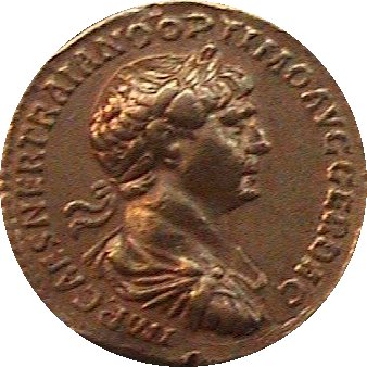 But it wasn't stronger than that of the Parthian Empire;
thus, the attempted-rape victim got in all the Part'n shots,
and the puppet ruler whom Trajan had placed into power
at the then-capital (Ctesiphon [D262], near Babylon [D256])
passed on soon after, as did Trajan (117 AD).
But it wasn't stronger than that of the Parthian Empire;
thus, the attempted-rape victim got in all the Part'n shots,
and the puppet ruler whom Trajan had placed into power
at the then-capital (Ctesiphon [D262], near Babylon [D256])
passed on soon after, as did Trajan (117 AD).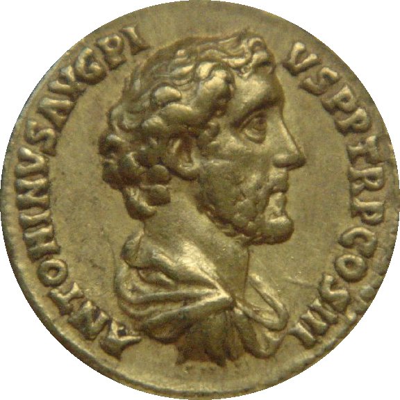 [Antoninus Pius aureus: DIO Collection.]